


CLICK HERE! For Electronic Services and Online Payment

CLICK HERE! For Electronic Services and Online Payment
THE ORIGIN AND NAME OF PUERTO PRINCESA
 Legend attributes the name of Puerto Princesa to a princess-like maiden of rare beauty who roams around the bay on certain times of the year during moonlight nights. At other times, she is seen sitting on a rock of the shore of Parola beach looking far out sea, as if waiting for her sailor- love to come home.
Authorities however, contend that the name was derived from the geographical location of the place as a port – being naturally protected from inclemency of the weather all year round. It has sufficient depth to allow ships of all sizes to anchor. It is truly a “Princess of Ports” or in Spanish “Puerto Princesa.”
Historical records, however, show that the place was named in honor of Princess Eulalia of Spain. She was born in 1864 to the Reigning Monarch, Queen Isabela II and her consort Dr. Francisco de Asis. But when the princess met an untimely death, the Queen changed the name to “Puerto de la Princesa.” Eventually, it was reduced to Puerto Princesa 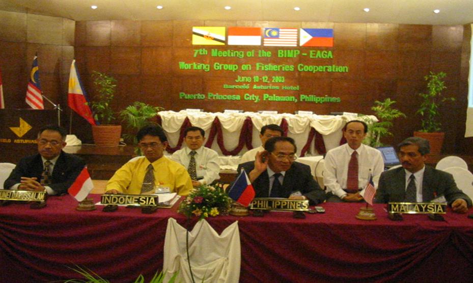 as it is known today.
NATIONAL SIGNIFICANCE
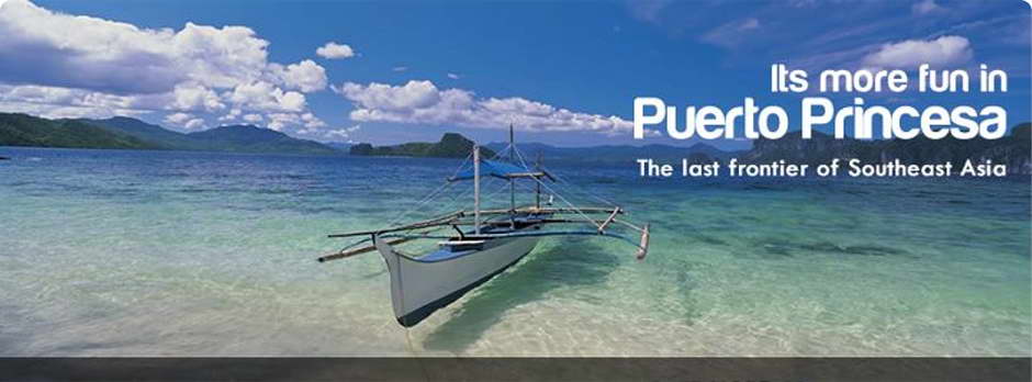
Puerto Princesa City has become the premier tourist destination in the Philippines. It has good access to Southeast Asian sea lanes and is near Vietnam, Malaysia and Brunei.
The Brunei-Darrusalam, Indonesia, Malaysia and Philippines East Asia Growth Area (BIMP-EAGA) which brings in, the participation of Puerto Princesa and Palwan in the growth initiative among the four countries has resulted in increased trading activities in the City. The perceived borderless economy has hastened joint venture cooperation, tourism activities and business travel within the area. The upgrading of the Puerto Princesa airport ha s brought about increased air traffic and trade links between Puerto Princesa City and the rest of the region.
REGIONAL SIGNIFICANCE
Puerto Princesa City is part of Mindoro, Marinduque, Romblon, Palawan (MIMAROPA) Region IV and among the active players in the regional development. Its airport and seaport are among the important transport links in the Region.
The City’s inclusion in the Special Zone of Peace and Development (SZOPAD) under Executive Order No. 371 has helped the City Government in its intensified development efforts particularly in the poor and depressed communities. Projects undertaken through the SZOPAD funds include water supply, irrigation, roads and other human development projects.
PROVINCIAL SIGNIFICANCE
Puerto Princesa is the capital city of the Province of Palawan. It is the center of trade and commerce, communication, education and government service. It divides Palawan into the northern and southern parts. A component city of the province, it constitutes about 17 percent of the total land mass of the province.
The Northern Palawan Tourism Master Plan has made Palawan one of the priority tourist destinations in the country. With the improved airport and seaport, a paved north-bound highway, together with improved access roads to tourist areas in the City plus good support services, Puerto Princesa has continued to enjoy the competitive advantage as the main gateway to the rest of the province. Thus it provides a good share of revenue benefits for its inhabitants.
Under the law, Puerto Princesa will have a financial share in the revenue benefits that Palawan gets from the operation of the Malampaya Natural Gas Project.
GEOGRAPHICAL LOCATION
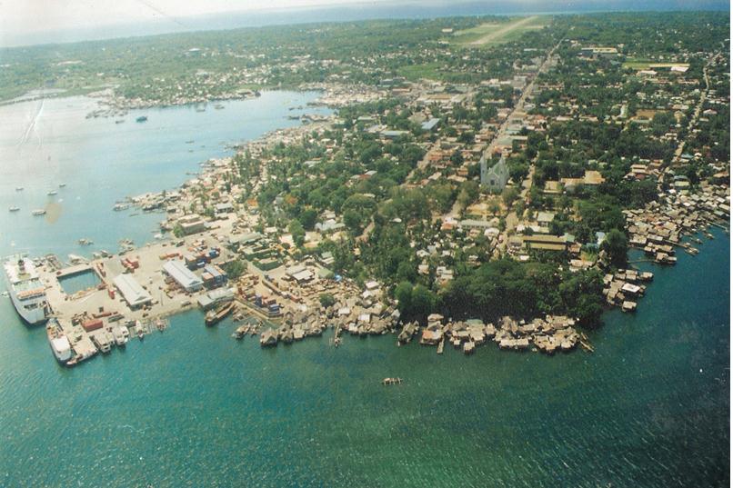
Puerto Princesa City lies in the heart of the long and narrow island Province of Palawan. It is approximately 306 nautical miles from Manila, 206 to Panay 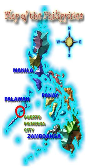 Island and about 250 to Zamboanga. It is 55 minutes by commercial airlines to Manila. It takes 18 to 20 hours by sea aboard the modern shipping lines that service the area from Manila and is about almost the same travel time from Negros Island.
The territorial jurisdiction of the City is bounded on the north by the Municipalities of San Vicente and Roxas and on the south by the Municipality of Aborlan. Its western side is the coastline of the South China Sea and on the east lie the Sulu Sea.
THE LAND
It is considered one of the largest cities in the country with a land area of 253,982 hectares or 2,539.82 square kilometers stretching over 106 kilometers long with its narrowest breadth of 8.5 kilometers at Barangay Bahile. Apportioned to 66 barangays of which 35 are urban while 31 rural.
While large in size, only 1.8 percent of the area is inhabited and a forest cover of 151,405 hectares, believed to be the biggest in any city in the Philippines. Puerto Princesa is aptly referred to as the “Princess City in the Last Frontier” of the Philippines.
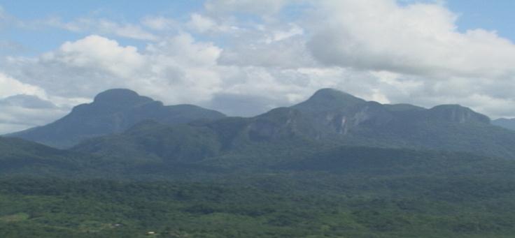
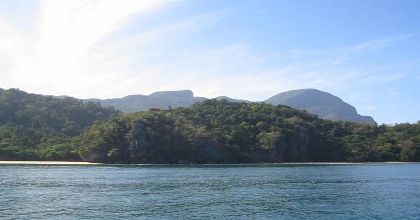
From the town, a chain of tall and majestic mountain ranges could be seen: towards the northwest, Mount Pulgar (1,208 meters) and Beaufort (1,121 meters); towards the southwest, the Cordillera of the Aldea and the Tres Pisos. The mountain ranges traverse the entire central length of the City, dividing it into two distinct areas: the east and the west coasts. The eastern side is characterized by thin strandlines bordered by swamplands, following a series of wide flat plains to hilly terrain. The west coast has less to offer, being pinched by craggy foothills and rugged mountains close to the sea. Generally, the terrain ranges from 10 to 1000 meters above sea level with rugged mountain areas in the interior. Its highest peak is Cleopatra’s Needle at 1,605 meters. The City has large productive areas of diverse marine ecosystems that provide shore protection and main source of food and employment in the fisheries and tourism sectors. Its coastline stretches over 416 kilometers and its coastal waters cover an area of 327, 586 hectares. Its mangroves which are important links between the shore and coastal ecosystems, cover an area of 5,917 hectares. Presidential Decree No. 2152 of 1982 declared the whole province of Palawan including Puerto Princesa City a mangrove reserve area.
 The vast Iwahig Prison and Penal Farm which has an area of 29,768 hectares offers good opportunities for farming of selected crops, livestock raising and other agricultural development. Negotiations on the plan to place the National Prison and Penal Farm under a joint management of the Department of Justice (DOJ) and the City Government of Puerto Princesa are underway. It is envisioned that Iwahig accommodate its resident prisoners in one portion of the area leaving vast lands available for sustainable agricultural activities that will greatly benefit the City’s economy.
CLIMATE
Puerto Princesa enjoys good climatic conditions. It is outside the typhoon belt of the Philippines and is rarely affected by the direct and strong winds of a typhoon.
The City has two prevailing types of climate. The type that prevails in the west coast has two distinct seasons: six months dry (November-April) and six months wet (May-October) with the heaviest record rainfall in September. The lowest or driest months occur in February. Western Barangays New Pangangan, Marufinas, Cabayugan, Tagabinet, Buenavista, Bahile, Macarascas, Simpocan, Bagong Bayan and Napsan fall within this type.
 On the other hand, the east coast has a short dry season with varying heavy rainfall months. Dry months have been recorded during the months of January to April.
It has two prevailing winds: the northeast (NE) monsoon and southwest (SW) monsoon. Northeast monsoon generally set in October and continues until April. It blows between north and northeast with a tendency towards an easterly direction at the end of the season. It has a velocity ranging from 15 to 25 kilometers per hour at its height and an average of six kilometers per hour. Rain clouds during the northeast monsoon practically lose all the moisture before reaching the southwest part of the archipelago. Thus the City and the Province as a whole receive no rainfall towards the end of the NE from January to April.
The southwest of summer monsoon follows the NE after a transition period of variable winds and calms. It prevails from June to October. It blows most steadily during July and August reaching a maximum velocity of about 35 kilometers per hour. In October or during the close of the SW monsoon, strong winds occur in the southern part of the City. The SW winds bring torrential rains but with uneven distribution.
Slight winds are present with some regularity during the two monsoons from December to April the northeast winds predominate. They usually affect the sea, making it rather rough. The southwestern winds predominate during the months of July up to the end of October, but with less intensity as the northeastern winds. With the change of winds come slight tempests that bring a sudden rush of winds with slight rains accompanied by thunder. These lightning and thunder do not usually cause accidents or calamities, since they are effected on the peaks of the mountains, which by their natural location and proximity to the shores, serve as natural lightning barriers to protect the inhabitants in the coastal areas.
The NE and SW monsoons affect the eastern and western part of the City. When these winds blow, the seas are very rough. The calm months of the year are from April through June on both the eastern and western side of the City.
TEMPERATURE
The City has a uniform high temperature. Generally, the warmest months are March, April and May. The coolest are November, December, January and February. It has more or less uniform as well as high relative humidity that range from 79 to 80 percent with an annual mean of 84 percent.
PEOPLE
Puerto Princesa is a melting pot of people with different cultures. This is attributed to the influx of migrants from other Philippine provinces, one of the reasons for the City’s high annual growth rate at 6.5 percent. The 2000 National Statistics Office (NSO) census show that it has a total population of 161, 912 of which 121,748 urban and 40,164 rural with 33,306 households.
The predominant local tongue is Cuyono. However, other languages like English and Filipino and dialects such as Cebuano, Ilocano and other dialect groups. But Filipino emerged as the common language of communication.
The people are predominantly Roman Catholics but all other religions as Islam, Jesus is Lord, Baptist, Iglesia ni Christo, etc. are practiced freely.
While Puerto Princesa is a culturally rich, lively and diverse community, there is respect for individual worth, tolerance of differences between people and collective responsibility for common goals. People have high regard for the environment and recognize the consequences of previous environmental neglect and lack of respect for natural resources.
Despite the rise in petty crimes, drug problem and vices, the peace and order situation in the City compares more favorably with most cities in the country and makes the City a fertile ground for investments. Its crime solution efficiency rate of 98 percent was the highest in Region IV.
TOURISM
 The City of Puerto Princesa is fast becoming a popular tourist destination capitalizing on its endowed natural beauty and rich biodiversity. Over a period of five years (1995-2000), the city’s yearly growth rate of tourist arrivals was 22 percent. Although it declined in 1998 by 10 percent, the tourism industry has remained stable.
On the average, tourists stay in the city for three or four days, spending Php 1,400.00 per person per day. The estimated amount of cash inflow from tourism industry in 2000 ranged from 400 million to 600 million pesos. This illustrates the impact of tourism industry in the city’s economy.
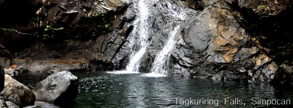
Existing and potential tourism areas in the city are being zoned and classified including the coastal zones of Napsan, Bagong Bayan, Simpocan, Nagtabon, and Tagcauayan in Bacungan and that of the northwestern and northeastern barangays as well as the islands and islets in Honda Bay. including the coastal zones of Napsan, Bagong Bayan, Simpocan, Nagtabon, and Tagcauayan in Bacungan and that of the northwestern and northeastern barangays as well as the islands and islets in Honda Bay.
Likewise, there are existing and potential eco-tourism areas in the City of Puerto Princesa which have continued to attract eco-tourists into the city. These areas include Puerto Princesa Subterranean River National Park (PPSRNP), Honda Bay, Ulugan Bay, Salakot Waterfalls, the surrounding forest and other natural and manmade sites.Its development have been done with minimum disturbance to ecology, consistent with the theme eco-tourism.
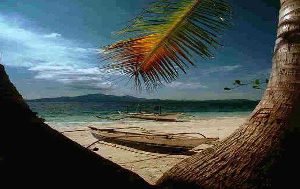
Puerto Princesa’s beautiful islets, scenic spots and places that evokes the pristine image of some exotic wonderland, is a living paradise.
The City has become a natural destination for eco-tourists, nature lovers, vacationists and researchers. It abounds in diverse resources and natural scenic spots which attract both local and international tourists to come to Puerto Princesa. The City won in 1996 the “Hall of Fame” Award for being the “Cleanest and Greenest Component City in the Philippines.” Together with this is a number of other awards in the area of environmental protection, sustainable agriculture, rural health delivery services, peace and order and functional literacy have supplemented the natural attraction of the City and made it more a popular destination point.
What Mayor Hagedorn did upon assumption of office after the Recall Election can best be appreciated in his message in THE 2003 ANNUAL PERFORMANCE REPORT. This report may be a good basis in projecting the future of Puerto Princesa City.
Every award and recognition that Puerto Princesa received became topics of discussion in the national tri-media; television, radio and print which generated plenty of goodwill for the city and its people, thereby helping Puerto Princesa regain its position as the haven of tourists and investors in this part of the world.
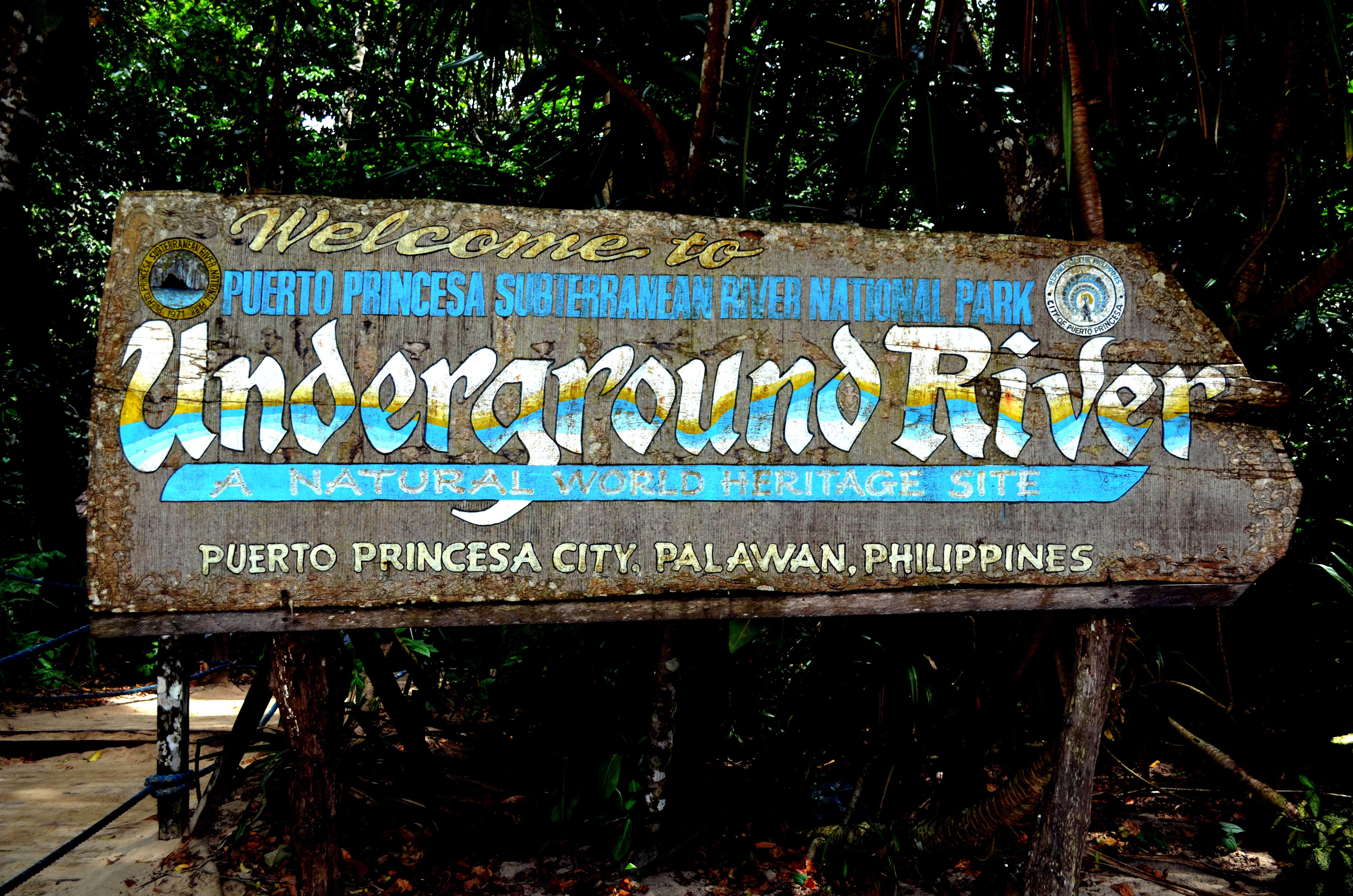
Founded on a plateau of virgin forest at the edge of a beautiful bay, Puerto Princesa since March 4, 1872 has risen to a most coveted place among the family of nations in the international hall of fame. With the eighth wonder of the world, the St. Paul Subterranean River, now named Puerto Princesa Subterranean River National Park in Sitio Sabang, inscribed on the World Heritage List on December 4, 1999. The Puerto Princesa Subterranean River National Park, along with the whole of the St. Paul limestone rock formation, some 81 kilometers north of Puerto Princesa City had been declared National Geological Monument in the Philippines.
The wilderness image of Puerto Princesa has long been attributed to be the reason for its slow development, let along neglect. Greed, power and authority abused its natural resources, forests, fishing grounds, were wantonly exploited, which gave Puerto Princesa a “damaged image” It took years to rehabilitate the damaged natural environment, slowly but steadily, concerned citizens began to restore and transform this damaged image which culminated with the election of Edward S. Hagedorn as City Mayor in 1992 .
Today, Puerto Princesa is “A City Paradise” according to Jose Galvez. (Leader February-March 2003):
If one is to describe the meaning of paradise and haven’t been to Puerto Princesa on the island of Palawan, then there will surely be a missing link to perfectly describe this scenic city.
In its tantalizing greenery and sparking blue hues, this wholesome city is literally full of natural surprises the springs from nature’s womb. An unimaginable concrete city built amidst the lushness of an island’s chameleon green cover and the mighty emerald blue sea.
Puerto Princesa City- capital of Palawan, lies in the heart of the long canopy-laden island province.
. . .If I were to describe Puerto Princesa, I would probably call it the “magical window to ecology.” . . . everything in the city seemed to be in perfect harmony with mama nature.Yet, in invoking the name of the Divine Providence, where can one find a super-clean city?
Nary a butt of spent cigarette nor a candy wrapper can be seen on the concrete streets and sideways.
Proof of this is the entry of the Cebu Pacific Air which invested millions of pesos to include Puerto Princesa as its service area, and the Asian Spirit thereby making the City accessible from Manila four times a day by air with one flight in the afternoon and from the City of Cebu. Also noteworthy are the WG & A and Negros Navigation Ships making the City accessible by sea twice a week. Negros Naviagtion also plies the Manila Negros-Mindanao routes while the Milagrosa and Montenegro Shipping Lines the Puerto Princesa-Iloilo routes. All these became necessary because of the 23.88 percent increase in tourist arrivals.
Another consequence of the “goodwill” that Puerto Princesa earned through effective local governance may be gleaned from the decision of the Malaysian-based airline, Layang-Layang Aerospace (LAY) to establish a direct flight between Puerto Princesa and Kota Kinabalu, Sabah.
The State of Sabah is perhaps one of the most visited places in Malaysia, garnering about 1.2 million visitors annually. Even if we get only a ten percent spillover from Sabah’s volume of tourists through the direct flight provided by LAY,that would translate to about 120,000 additional tourists for the City per year, very certainly a big boost to our local tourism industry. However, the direct flight to Kota Kinabalu did not materialize as of this writing (2006).
The World Heritage Committee. The World Heritage Committee is an intergovernmental organization responsible for cataloguing and protecting sites throughout the world that possess significant historic and cultural value. The World Heritage Committee operates under the United Nations Educational Scientific Cultural Organization (UNESCO). It was established to implement the terms of the World Heritage Convention, an agreement to preserve world’s natural and cultural heritage adopted by the General Conference of UNESCO in 1972. To date, 147 nations have signed the agreement.
The World Heritage Committee selects a diversified number of sites for preservation, including monuments, sculpture and paintings, cave dwellings, architecturally significant buildings and places of natural importance. Site chosen by the Committee receive international protection through the resources of the World Heritage Fund, which provides both financial and preservation assistance. There are more than 500 World Heritage Sites. (Microsoft Encarta Encyclopedia 200)
 WORLD HERITAGE SITE
Outstanding among the scenic spots is the “eighth wonder of the world” – the Underground River at St. Paul’s Bay. A visitor once described the scenic beauty in these words:
Nothing but an artist’s pencil could tell the story. Photographs give the outlines and convey no adequate conception of the marvelous detail of line and color. Nature’s sculpture is everywhere. The scene changes . . .the note becomes that of ancient Egypt. Carved by time itself, unaided by the hand of man there reposes a complete and finished griffin (or is it a sphinx by time as amid thesands of time?). Between stately stone pillar rise a series of steps leading from the water to some temple within. Then the cavern stretches away an almost perfect rectangle with walls and ceiling decorated with many colors- - surely the deft work of an artistic, designing hand. One sharp turn of the way and there appears a huge stalactite glittering like a chandelier from the ceiling of some great ballroom. Suddenly the boat glided into a great chamber resplendent with colors and decorations like a stage set for a scene in some grand opera. (Brochure. Palawan: The Last Frontier 3).
 The Puerto Princesa Subterranean River National Park was inscribed on December 4, 1999 by the United Nations Educational and Scientific and Cultural Organization (UNESCO), a World Heritage Site, on the merit of its magnificent subterranean river with unique natural formations that empties into the sea.
Furthermore, the whole Park, with the exception of small areas near the underground outflow and the administrative area of the Central Park Station, is covered by primary forest which is home to many endemic species of animals and plants. This dense tropical forest which forms the watershed area of the river is within the boundaries of the Park. It also encompasses an unusually wide variety of ecosystem. It is therefore of high scientific and conservation interest.
 The PPSRNP is the only national park in the Philippines situated within the city’s boundaries. Thus, all the environmental preservation programs and maintenance are meticulously undertaken by the City of Puerto Princesa under the leadership of Mayor Edward Solon Hagedorn, whose successful environment programs have won national and international awards for the city government.
At Marrakesh (Morocco) the UNESCO World Heritage Committee inscribed PPSRNP on the World Heritage List with this inscription:
“The PPSRNP features a spectacular limestone karst landscape with its underground river. A distinguishing feature of the river is that it emerges directly into the sea, and the lower part of the river is subject to tidal influences. The 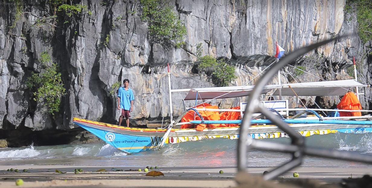 area also represents a significant habitat for biodiversity conservation. It contains a full “mountain-to-the-sea” ecosystem and protects some of the significant forests in Asia”
On December 11, 2003, the PPSRNP was also proclaimed a “National Geological Monument” by the National Committee on Geological Sciences in recognition of its scientific importance as a permanent laboratory for studies on geological processes, uniqueness and high scenic value.
HISTORY
The St. Paul Subterranean River has a very long history. Commander Bates of the English navy, while exploring the coast of Palawan in 1850 saw the subterranean river. He named it St. Paul for he likened it to the dome-shaped St. Paul Cathedral in London.
The Batak tribe lives in the area call the subterranean river as Natuturingan Cave, because of their fear of of spirits and animals living inside the caves prevented them from going inside its depths. Located at the west coast of the long strip of island of Palawan, some 81 kilometers from Puerto Princesa City proper, the St. Paul Subterranean River National Park (SPSRNP) was established on March 26, 1971 by virtue of Presidential Decree (P.D.) 835 to protect its unique and cultural features. Originally, it encompassed 3,901 hectares.
In conformation with Republic Act No. 7160 of 1991 or the Local Government Code, the Department of Environment and Natural Resources (DENR) in a Memorandum of Agreement transferred the responsibility of the management, protection, rehabilitation and development of St. Paul National Park to the City Government in 1992.
Then on November 12, 1999, the President of the Philippines signed Proclamation No. 212 renaming the St. Paul Subterranean River National Park to Puerto Princesa Subterranean River National Park (PPSRNP) and expanded its area of coverage from 3,901 hectares to 22,203 hectares.
GEOLOGY
 The first documented exploration inside the cave was led by Dean Worcester, an American, in 1887. The cave has a total surveyed length of 22 kilometers, making it the longest cave in the Philippines. The navigable portion is 8.2 kilometers.
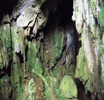
The gray rocks, making the walls are called limestone. They were formed under the sea about 23 million years ago. Changes in the earth caused the limestone to be exposed above the sea, allowing rain water to move through the small cracks in the rocks and dissolve the limestone much like hot water melting a block of ice. It took rain water thousands or even millions of years to enlarge the cracks into the passages as caves. The yellow rocks are called cave formations. The St. Paul Underground River is part of the Cabayugan River which disappears into the ground and becomes the St. Paul Underground River.
Inside the cave is a large formation called “Cathedral” because it resembles the dome of a huge cathedral. At the right of the cathedral is a formation which resembles the Virgin Mary and a Giant Candle, these are examples of stalagmites. They were formed from water dropping from the ceiling to the floor which left behind minerals that dissolved it into calcite. This is a very slow process, the changes of which cannot be noticed even in a lifetime. The estimated normal rate of growth of these formations is only a fraction of a millimeter per year.
The candle is called stalactite. This was formed when water escaped the cracks in the ceiling which left behind some minerals before it dropped to form a stalagmite. The formation of jellyfish inside is an example of a flowstone. It was formed when water flowed on the walls of the caves and left a blanket of minerals. The giant mushroom is a beautiful flowstone.
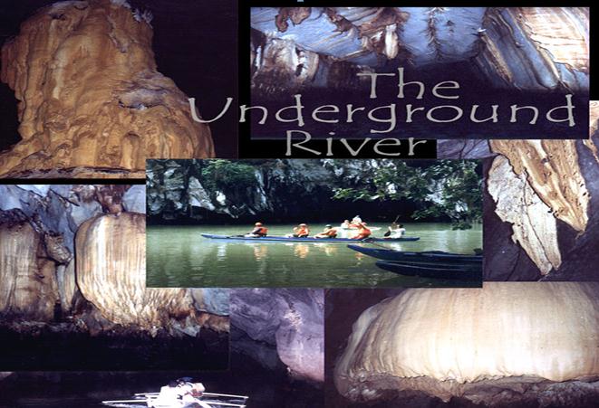 There are a series of blankets called growth rings which were formed over the previous blankets. The highest point is 65 meters above the water level. This was formed due to the abundance of cracks in the area and the fast flow of rain water. At the walls are a series of grooves. These are called notches and were formed by water. This indicates that the water level was once at that level.
The small stalactites are called soda straws because they resemble straws’ hollow centers where water flows through in droplets. The Highway is 200 meters portion of the cave which follows the large cracks, a result of the flow of rain water through the cracks. The thin formations found on the parallel walls of the highway called curtain or draperies. They are special type of flowstone. They are also called bacon as they look like it. The black and white lines that make the curtain resemble that of a bacon, was caused by the flow of the water over the thin portion of the walls.
The weird stalactite in the cave is called Egret because of its eccentric formation which is different from the other stalactites. This was formed when the water droplet hanged on for a long time before it dropped that allowed the wind to move it from side to side where it left behind the dissolved minerals.
CAVE BIOLOGY
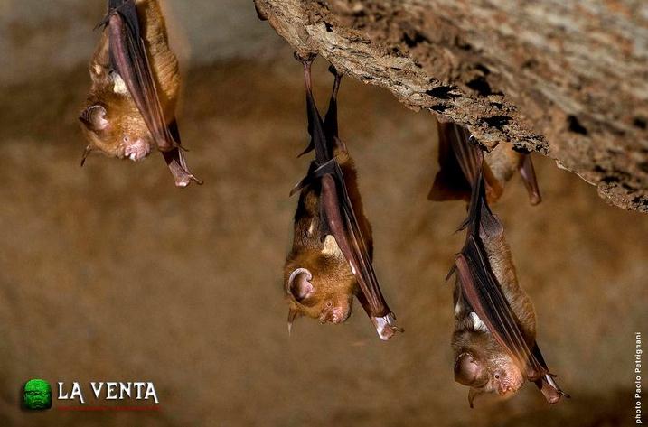 The bats and swifts found in the cave, live part of their lives inside and outside the cave. They leave the cave only to look for food. They rest and breed inside the cave. They are called troglophiles. They use sound, called echolocation, to fly and locate themselves in the dark. There are 65,000 of individuals of eight species of bats and at least two species of swiftlet roost in the cave. The other animals that live throughout their lifetime in the cave are called troglobites. While those who only visit the cave for short time called trogloxenes, such as snakes and other fishes. Occasionally, shrimps and eels are found inside. It is not known whether or not they stay permanently in the cave or just washed in from the open sea.
THE ST. PAUL LIMESTONE ROCK FORMATION AND THE PETROLEUM WEALTH OF PALAWAN
 The limestone of Ulugan Bay and the limestone of Bacuit Bay are two totally separate rock formations. They are also ages apart, the one in Puerto Princesa is only 50 million years old while the one in El Nido is 250 million years.
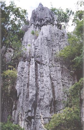
If the St. Paul Limestone Rock Formation is an iceberg, then Mt. St. Paul is only its tip. The main body of the rock formation is under the sea and extends all the way to the Malampaya oil fields of Palawan. It is in fact the reservoir rock for Palawan’s offshore petroleum. If this is difficult to believe look at a map of the world and note how tiny the entire archipelago of Palawan is compared to Saudi Arabia. The reservoir limestone formation of Saudi Arabia petroleum is even more extensive than the St. Paul limestone. Unfortunately, the petroleum maps of 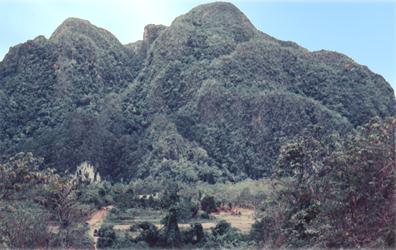 the Malampaya oil field has been erroneously referred to as El Nido limestone instead of St. Paul limestone.
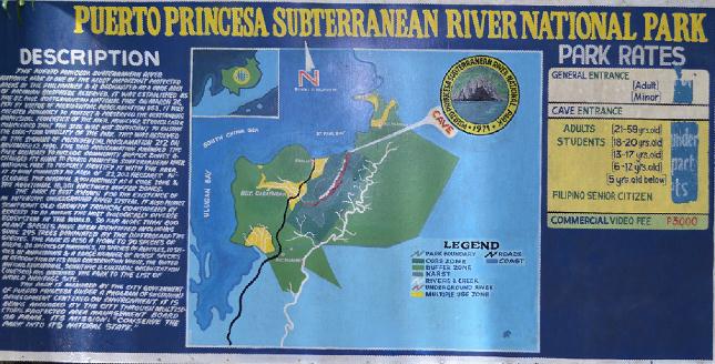
THE PUERTO PRINCESA SUBTERRANEAN RIVER NATIONAL PARK
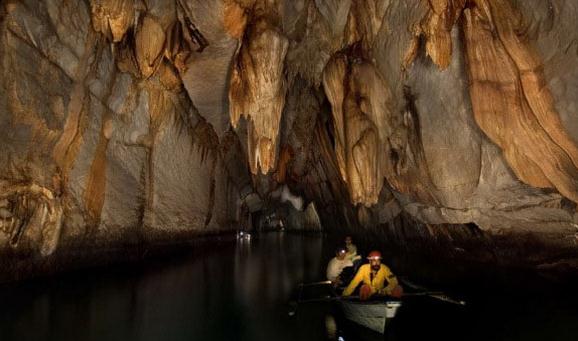
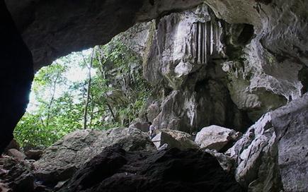
Its main feature is an 8.2 kilometer long underground river that flows toward the South China Sea under a spectacular massif limestone or karst known as the St. Paul Mountain Range, rising 1,028 mouth is a clear lagoon teeming with brackish water fish and other forms of marine life. A white sand meters above sea level. The river is claimed to be the longest in the world. At the entrance of the river’s beach clumped by ancient trees meanders at the water’s edge. Monkeys, monitor lizards and squirrels find their niche on these trees.
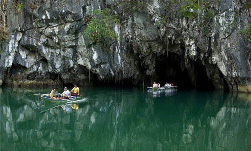 The lowest four-kilometer of the river is navigable by small boats and now attracts 40,000 visitors annually generating considerable revenue, equivalent to over 80 percent of Park expenditure.
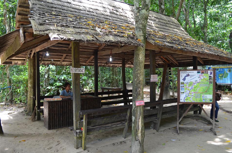
The Park strictly enforces a “NO PERMIT, NO ENTRY” policy. Visitors are required to register and given a short briefing at the Park Headquarters before being allowed to proceed to the Park area.
Apart from the underground river, are other attractions where community guides are available. The tour guides are out-of-school youths who have been trained for the purpose.
These are:
JUNGLE TRAIL The Park’s 1.5 kilometers Jungle Trail is a good treat to hikers and trekkers. Guided only by orange marks on trees, this trail leaves one to explore on foot the Park’s intact tropical rainforests. The Park’s diverse form of land systems represents all except two of the lowland forest formations of the tropical Far East Asia.
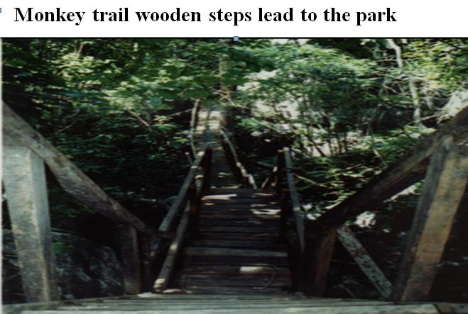 MONKEY TRAIL An alternate route to the underground river is through the Monkey Trail. A four-kilometer trail passing Sabang beach leads to the interior forest of the park where monkeys and other forms of wildlife may be seen. The two-hour hike ends in the 355 wooded and paved steps up toward the underground river. The climb atop the steps gives the hiker a fresh view of the Park over the karst. Note: Beware of playful monkeys.
DAYLIGHT HOLE. It takes about one hour and 30 minutes hike from the main road in Cabayugan to the foot of the Daylight Hole, which is found at the top end of a 150-meter climb up the karst. So-named because of the large hole that opens to the sky at the end of the cave’s high and wide mouth. This is where the sunlight streaks through forming a cascade down to the bottom of the limestone wall. The hole provides the only ray of light to the visitors paddling their way in the long, pitch-black river underneath.
 The trail to the Daylight Hole passes by the inflow, the point where Cabayugan River disappears through the massive limestone walls and continues inside forming the underground river.
LION’S CAVE. The cave is eight kilometers away from Sabang. It is 200 meters from the side of the national highway towards Barangay Cabayugan.
Its dry cave entrance is guarded by a lion- shaped stalagmite. From the wall at the opening on the other side are various figures likened to be carved from an artist’s hand. The lion-shaped stalagmite was formed by droplets from a drape-like stalactite. The cave offers a good view of the rice fields below.
CAWILI CAVE. It is 30 minutes hike from the main highway. An opening halfway to the top provides a window with a fresh view of Mt. Capuas and the rice fields over Cabayugan. The cave has main galleries and openings on its sides.
SABANG WATERFALLS. It is a short twenty–minute hike from the Sabang pier and offers a cool, refreshing water pool at the base before emptying into the sea.
 PARK VISITOR CENTER. It is a semi-concrete structure of native design with a 40-person capacity main gallery. The main building serves as the main booking and administrative office in the area, while a separate structure in the same site houses a canteen and public comfort rooms. The project was financed by a grant from the European Union through its Palawan Tropical Forestry Protection Programme.
The Visitor Center also serves as the picnic area, designated by the Protection Area Management Board (PAMB) chaired by Mayor Edward Solon Hagedorn.
 MALIPIEN R
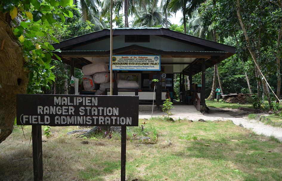 ANGER STATION. Formerly known as the Central Park Station, the area has been converted into a restoration zone and renamed Malipien Ranger Station. It is the habitat of some of the City’s and Province’s endangered species such as the cockatoo o r katala, scaly anteater or balintong and the Palawan porcupine or durian, to name a few.
The Central Station used to provide the only accommodation for Park visitors in the early days when the Park was created in 1971. Transport then to and from the Park was difficult by sea enroute Ulugan Bay in Barangay Bahile.
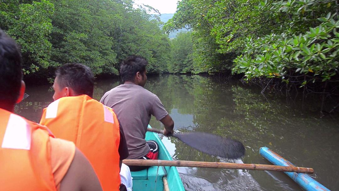 CENTURY-OLD MANGROVE FORESTS. Latest of the opportunities opened in the Puerto
Princesa Subterranean River National Park (PPSRNP) is the Mangrove Interpretative Paddleboat Tour, a 45-minute tour through the Sabang River in Barangay Cabayugan. It showcases the Park’s almost four hectares of century-old mangrove forests.
Paddleboats with a carrying capacity of eight persons and operated by trained oarsmen take walk-in visitors to a tour through the four- kilometer long Sabang River. With the package is an interpreter-guide who explains the mangroves ecological importance, uses and its significance for conservation. The tour employs out-of-school 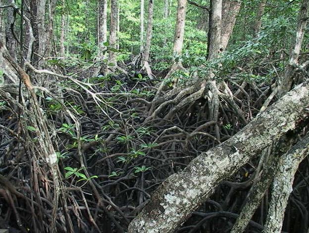 youths as guides and boat-paddlers The project is an initiative of the Puerto Princesa Subterranean River National Park under the City Government of Puerto Princesa City in cooperation with the Conservation International (CI), the Palawan Conservation Corp (PCC) and the local communities of Barangays Cabayugan and Tagabinet.
ETHNOGRAPHIC SITE MUSEUM. The site museum in Barangay Cabbayugan , right in the heart of the Puerto Princesa Subterranean River National Park (PPSRNP) presents two very distinct ethnic groups: the Batak and Tagbanuwa. These two groups show different cultural perspectives that play a major social context in Palawan and Puerto Princesa City in particular, in the conservation and preservation of their living heritage.
The Bataks, the smallest of the Palawan ethnolinguistic groups are rapidly disappearing. There are approximately 1,780 Bataks occupying 13 settlements located along the seacoast and in the interior mountains of Puerto Princesa, between the Babuyan River and Barangay Malcampo. Their language is Atronesian in origin.
On the other hand the Tagbanuwa is one of the few remaining ethnolinguistic groups in the Philippines still using a type of syllabic writing which was widely spread in the country prior to the coming of the Spaniards. Their system of writing has been declared in 1999 by the UNESCO as “Memory of the World.”
THE COMMUNITY-BASED SUSTAINABLE TOURISM
The Master Plan for Community-Based Eco-Tourism in Ulugan Bay, Puerto Princesa City, is the product of the Green Globe Community-Based Sustainable Tourism (CBST) Workshop held in this City in June 1999.
The Vision is: Ulugan Bay will offer high-quality educational community-based sustainable tourism products and services reflective of our rich local culture and uniquely diverse natural environment. We invite visitors to share our commitment to environmentally and culturally sound tourism development through the mutual co-operation of all stakeholders in order to uplift our overall standard of living.
Aims and Objectives. The Community-Based Eco-Tourism Master Plan represents a single component within a wider project whose ultimate objective is to generate an empirical model for integrated coastal resource management.
The scope of the project encompasses the coastal and marine environs of Ulugan Bay intended to support the UNESCO’s Declaration of Palawan as a Biosphere Reserve (1991); the Strategic Environment Plan of Palawan (SEP, 1992); the National Integrated Protected Areas System Act of the Philippines (NIPAS); the Environmentally Critical Areas Network (ECAN): and the Declaration of Puerto Princesa Subterranean River National Park (PPSRNP) as World Heritage Site.
The Biophysical Environment of Ulugan Bay. It is situated in the central western coast of Palawan Province. The Bay is comparatively large, covering an area of 7,200 hectares with both deep and shallow marine areas. The bay contains approximately 100 kilometers of coastline and several islets and islands, the largest of which is Rita Island. The coastline is punctuated by a number of smaller inlets such as the Tagnipa Inlet on the east coast and the much larger Oyster Bay on the west coast. At its northern end, the mouth of Ulugan Bay is flanked by a peninsular on its southern side and Piedras Point to the north.
The majority of Ulugan Bay is underlain by ultramafic rocks of the Mount Beaumont complex outcropping mostly of Boayan Classic of the Panas Formation with outcrops of metamorphosed limestones (black, white and gray marbles) in the area around Saint Paul’s and Cleopatra’s Needle (Kayasan Certificate of Ancestral Domain Claim). Alluvial plains, tertiary sandstones and shales characterize the coastlines. Two thrust-faults transect the area, one running along the bay’s coastline between Bahile and Macarascas and the other trending southwest/northeast between Cabayugan Centro and Sabang.
The coastal flats, which ring the bay, do not normally extend more than few kilometers before rising steeply to from a high rugged hinterland. In the lowland areas the forest cover has been largely cleared for farming and settlement, however, the mid-upper slopes still retain extensive areas of secondary and primary forests. Eleven comparatively small rivers drain Ulugan Bay’s water catchment. These rivers include the Tarunayan and Kayulo on the western side; the Omalagan and Bahile in the southwest; Baruang, Sia and Eddasen in the south and the Karangie, Banog, Otaban and Tagnipa to the east. The Babuyan River, which is the longest river in Palawan (54 kilometers) flows from the highlands behind Barangay Tagabinet and Kayasan CADC, to Honda Bay on the east coast of Palawan. In the upper reaches, these rivers are typically steeply graded, fast flowing and ‘flashy’, whilst in the lower sections their gradient and velocity decreases allowing mangroves to develop along their margins.
Biogeography. From an ecological perspective, Ulugan Bay is characterized by a high level of bio-diversity. In the bay’s marine environment, both shallow and deep-water areas, coral reefs, sea grass meadows and seaweed beds can all be found. The deep-water areas (10-14 fathoms) contain flounder, hard tails, threadfin, bream, billfish, lizardfish, jacks, tuna, mackerels, scads, snappers, shark and stingray.
Two areas of patch-reef located in the bay’s central and southern reaches (Bulalacao and Putting Bato) whilst fringe-reefs can be found in Oyster Bay and off the coasts of Rita Island and Barangay Buenavista. Collectively, these coral reefs cover a total area of approximately 1,235 hectares, with Oyster Island and Rita Island containing 31 and 27 coral species respectively and accounting for more than 40% of the total area. On the reefs numerous faunal species can be found, plus squid and octopus. In addition, a variety of fish species, such as parrotfish, groupers, fusiliers and surgeonfish, are also present with sea turtles coming ashore to nest on a number of beaches.
Beaches (both sand and silt), mangroves and tidal flats/estuarine environment characterized the coat of Ulugan Bay. In the near-shore environment, slipmouth and silverside can be found, whilst the tidal flats, estuarine and lower riverine environments are home to mullet, stonefish and catfish. Extensive areas of sea grass meadows can be found along the seashore edge of primary and secondary growth mangrove forests in the inner bay. These marine meadows are home to starfish, sea cucumbers, seahorses, mud/blue crab and rabbitfish with reported sightings of Dugong in the quieter areas nearer to the bay’s seaward sea grass lies extensive stretches of secondary and primary growth mangrove, covering a total area of over 790 seaweed beds, small islets and smaller islets, account for around half of Palawan’s total and 15 percent of the national reserve with 56 percent of the cover greater than 50 percent.
In conjunction with the 500 hectares of seaweeds found within Ulugan Bay, the mangrove forest, sea grass meadows and coral reefs act as important breeding grounds and nurseries for a large and diverse range of fish species (around sixty in all). These mangroves not only function as marine hatcheries and nurseries for species such as shrimps and oyster but also as sediment traps, impounding material eroded and transported by over-land flow and rivers from the surrounding uplands. The retention of this sediment is crucial in, not only preventing siltation and subsequent coral smothering, but also in maintaining the low levels of water turgidity which are essential if sunlight is to penetrate the clear seas to the depths necessary for healthy coral growth.
On land, extensive mature mangrove and primary rainforest can be found populated by primates, bear-cats (Arctictis white), large monitor lizards, a variety of birds and a number of butterfly species, some of which are unique to the area.The dramatic karst outcrops, which typify the northern sections of the bay where reptiles, insects, birds (swiftlets) and numerous species of bats.
Demography, Society and Culture. The vast majority, of the estimated number of 6,000 persons live in the five barangays of Bahile, Macarascas, Buenavista, Tagabinet and Cabayugan. The five barangays comprise 1,617 households, in 32 puroks and sitios covering a total area of approximately 253,982 hectares.
In addition to the five barangays residing in Ulugan Bay are two Certificate of Ancestral Domain Claim (CADC), Cabayugan in Barangay Cabayugan and Kayasan in Barangay Tagabinet. The Batak and Tagbanua are found in Kayasan, while only the Tagbanua are in Cabayugan. Other family groups from the two ICCs are found in and around Tagabinet and Buenavista.
THE PRIMARY STAKEHOLDERS
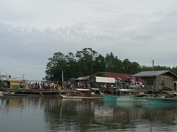
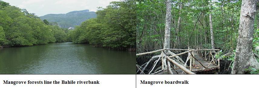 Barangay Bahile. It is located at the innermost, southwestern portion of Ulugan Bay. The area is characterized by forested upland slopes giving way to a lowland coastal strip fringed by mangrove. In the more populated areas, forest cover as been largely cleared for small scale agriculture. The main settlement (Centro) is situated alongside the road leading from Puerto Princesa to Sitio Sabang. A side road leads the short distance from the main thoroughfare to a concrete landing pier located on the banks of Bahile River. The pier includes a spacious covered area with open sides, opposite which are simple toilet facilities.
The Bahile River is broad with mangrove lining the riverbanks in both an upstream and downstream direction. The river discharge is comparatively stable (non-flashy a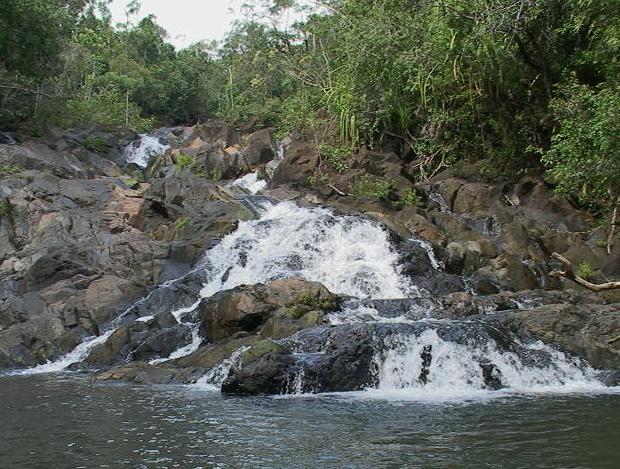 nd perennial) flowing into Ulugan Bay a few kilometers downstream. At Bahile proper, the river is lined with mature mangrove whilst in Ulugan Bay, around the river’s mouth, the mangrove includes areas of reforestration (planted seedlings), secondary and primary growth. Upstream of the pier, the mangrove-lined riverbanks give way to lowland forest cover with the navigable section of the river ending a series of low shallow rapids or riffles approximately 23 kilometers upstream from the wharf at Bahile. The upland areas are generally heavily forested with Mount Bahile and Mount Peel forming two major landscape features.
The majority of the land in Bahile is under public ownership. The area around Bahile River and Barangay Centro is classified as ‘Alienable and Disposable’, whilst the other areas extending along the west coast of the bay, Tarunayan, Oyster Bay and Manabore, are designated as ‘Forest Lands’. Only very small are privately owned or under long –term leasehold agreement.
Bahile has certain features which could be developed into tourist attraction: the Bahile River with its waterfalls and access to Ulugan Bay; extensive mangrove and lowland forests; wildlife; and festivals in February, March and June.
The Bahile River Paddleboat and Forest Trail Tours provide tourists with a paddleboat rental service with guide to tour up-stream from the concrete pier, a distance of from two to three kilometers, to see the varied wildlife, most especially the mature ‘mother trees’ along the forest trail and the ‘mangrove tour’ in its extensive mangrove area. A wooden foot-walk from the Bahile River pier about one kilometer downstream in the mangrove area can provide the tourists an easy access to the area.
In about two to three kilometers from the point where the river is not navigable, the Bahile River drops three to five meters over waterfalls. These falls are accessible by road leading from Bahile proper, a distance of approximately five kilometers.
 Barangay Macarascas. It lies at the mouth of the Bahile River. This part of the river and surrounding coastline of Ulugan Bay is extensively vegetated with primary, secondary and reforested mangrove. Located in the barangay are small pension/restaurant (Vident Lodge and Yolliby Eatery), and sari-sari stores.
At Sagasa Point, the Coastal Resource Management (CRM) Project has constructed small experimental fishpens, aimed at developing a sustainable form of community-based fish farming for later application elsewhere in Ulugan Bay. To the west of Bahile River is Puting Bato, which has a significant area of coral reefs.
A Naval Station is located on the eastern side of Sagasa Peninsular close to the mouth of the Bahile River.
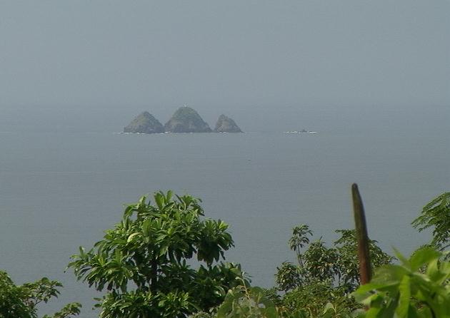
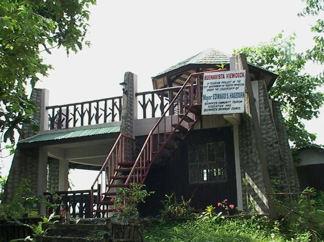 Barangay Buenavista. It is a derivative of the Spanish phrase “buena vista” which means ‘good view’. The view from the upland areas within the barangay, including sections of the Puerto Princesa City- Sabang road is dramatic. From a variety of vintage points Oyster Bay and Rita Island can be seen directly opposite the main beach; to the north, the rocky outcrops of ‘Tres Marias’ are clearly visible in the seaward mouth of the bay. Along higher sections of the road to Sabang, portions of the tower karst formation of the St. Paul’s can be viewed over the intervening areas of dense forest.
Buenavista lies mid-way along the east coast of Ulugan Bay. The Barangay Center is adjacent to the road. The main population is clustered along the extensive stretch of the beach which parallels the roadway. Mangrove patches and tidal flats are found in the sandy beaches. The near-shore environment fringing coral reefs and tiny tertiary sandstone islet, Manyukos Island, lies a few hundred meters off shore.
 The Community-based Sustainable Tourism recommends the following activities: paddleboat/sailing paraw, snorkel and mobile beach facility; permanent beach front bay shelter rental; a view deck in Manyukos Island; interactive/educational farm-stay tourism and a roadside view deck along a high section of the road to Sabang and possibly an Ulugan Bay showroom.
The interactive/educational farm-stay tourism is a concept designed to access the growing market for interactive and education tourism. Buenavista is ideal because its farms are located in small valleys adjacent to the road. These picturesque valleys contain small streams that provide the water necessary for irrigation. The fields are bounded by an intricate network of small ditches, canals and embarkments to control the flow of water from one field to the next. This water resource management system is a skill that is often under estimated by those not engaged in its use. Visitors can stop in the barangay and learn to take part in farming activities, a rare and unique experience. They may also be interested to stay overnight and experience rural life.
The Buenavista view deck/showroom along a high section of the road to Sabang has a commanding view of Ulugan Bay, Oyster Bay, Rita Island, the Tres Marias and sections the karst formation of Saint Paul’s in the north.
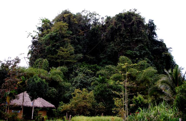 Barangay Tagabinet. The barangay is situated on the northeastern flank of Ulugan Bay, along the northern section of the road from Puerto Princesa City to Sabang. It includes a short stretch of Ulugan Bay coastline, edged with mangrove, sea grass and corals. The main settlement is situated a few kilometers inland of Tagnipa Inlet. Rugged uplands, dramatic karst outcrops and dense areas of primary forest, edged with mangrove, sea grass and corals. The main settlement is situated a few kilometers inland of Tagnipa Inlet. Rugged uplands, dramatic karst outcrops and dense areas of primary forest, edged with mangrove, sea grass and corals. The main settlement is situated a few kilometers inland of Tagnipa Inlet. Rugged uplands, dramatic karst outcrops and dense areas of primary forest. A short distance from the Barangay Hall in Tagabinet Centro, a dramatic tower-karst formation rises from the surrounding farmland to a height of between 60 to 79 meters. This outcrop,
 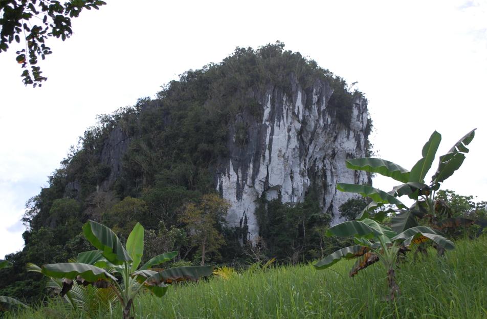 Ugong Rock, is composed of black, white and gray marbles interspersed with lime stones that typify the area. Over time, the tropical climate has eroded the geology, exploiting weaknesses within the body of the rock. This process has resulted in the creation of sharp pinnacles and ridges on the exterior with numerous fissures and tunnels containing speeothems or flowstones in the interior, stalactites, stalagmites and pillars. In one chamber, a large flowstone has formed which when tapped lightly, produces haunting musical no tes. It is this flowstone which Ugong Rock its name.
The Tagabinet butterfly trail is an extension of developing butterfly farms where trails are lined with plants to attract butterflies and to sustain them.
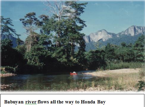 The Babuyan River may be developed into a water-based recreation for swimming, paddleboat riding and rafting. The journey along the trail leading from Tagabinet Centro takes twenty to thirty minutes on foot. The river flows all the way to Honda Bay on the east coast of Palawan attracts tourists to take a ride for a two-hour trip downstream to the bay.
The Tagabinet-Kayasan CADC bush trail from Tagabinet to Kayasan CADC Centro is some eight kilometers away. The trail passes through areas of tall rifer grasses and secondary growth forest, crossing the Babuyan River a number of times. The trail itself is comparatively flat and so arduous and can be completed in a little over two hours each way.
Kayasan CADC. Development strategies in the Kayasan CADC are built upon the environmental and cultural potentials without degrading these resource bases. These assets include: extensive areas of primary forest, 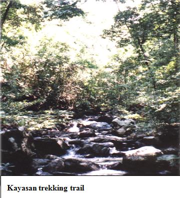 massive karst formation containg numerous cave systems; an extensive foot-trail network; the Babuyan River and its waterfalls, feeding into Honda Bay on the east coast of Palawan; numerous creeks feed into Babuyan River; a wide variety of wildlife, wild boar, primates, Palawan bear-cat, wild cat, porcupine, monitor lizard, flying squirrel, etc.
The following activities may be undertaken: Kayasan trekking trails passing through the rivers, creeks, waterfalls, caves, forest where one finds “mother trees” and various wildlife; presentation of traditional Ceremonies and practices as tarek, a male dance; diwata, a healing ritual; saad, a war dance; and lakwang, performed on the basis of the lunar cycle (once or twice a month) to make its more symbolic; and tree climbing technique; and the sale of handicrafts. The Batak and Tagbanua produce a number of products that could be sold to visitors such as musical instruments, hunting and gathering implements, wooden pouches, baskets and traditional form of backpack. Special sessions could be arranged where the old folks demonstrate their traditional system of ‘syllabary’ writing.
PROMINENT LANDMARKS
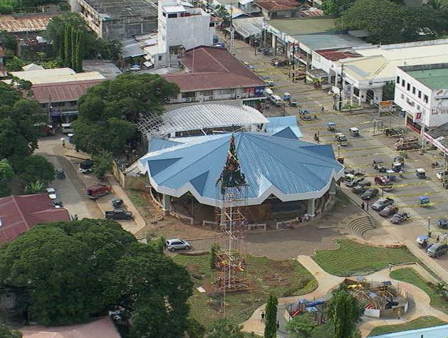
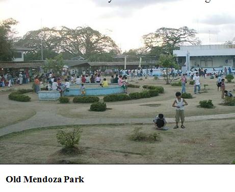
MENDOZA PARK
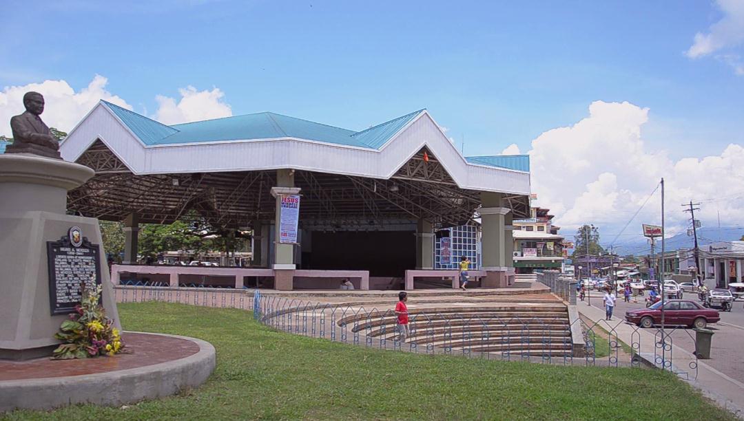 It is named in honor of Dr. Higinio Acosta Mendoza, Sr., a Provincial Governor of Palawan and war hero. His resistance to Japanese control resulted in his execution on January 24, 1944 at Canigaran Beach, Puerto Princesa. His remains were interred into the memorial shrine in Mendoza Park, named after him.
Dr. Higinio A. Mendoza Sr. was born on July 27,1898 in Puerto Princesa. He is the fifth child in a family of six. His parents were Agustin B. Mendoza and Juana Acosta.
He married Trinidad Palanca Clark, a charming and exquisitely beautiful lady of Puerto Princesa. The couple was blessed with four children: John, Higinio, Jr., David and Julie.
 As a student in the United States, Dr. Mendoza had demonstrated his strong and dynamic qualities of leadership. He founded the Philippine Students Club in the University of Iowa and Philadelphia. He held prestigious positions such as : Chairman of the Foreign Students Association in Iowa University; Associate Editor, Mannemann Medical College Yearbook, the Medic, in 1928; and President for two terms of the Filipino Association of West Philadelphia Homespatic Hospital. He returned to the Philippines with the degree of Doctor of Medicine.
However, he left his luxurious medical practice, after much persuasion, to run as Governor of Palawan. He was first elected in 1931 and re-elected in 1934. He would have served a third term had he not transferred the then only high school in the province from Cuyo to Puerto Princesa.
As Governor, he did much for Palawan. He was responsible for the extension of the road from Iwahig to Aborlan. A lover of nature, he beautified Puerto Princesa by planting “balayong” (Palawan Cherry Blossoms), banaba and 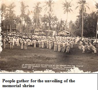 fire trees along the roads. More specifically, he is better remembered for planting rare plants and protecting animals which are endemic to Palawan. He was also responsible for the installation of the water system in Puerto Princesa.
As always, frustrations got the better of an enthusiastic and development-oriented executive. In his frustrations for not getting substantial assistance from the national government, Dr. Mendoza in 1936 prompted the signing of the Provincial Board Resolution for the secession of Palawan from the Philippines. His intention was to attach Palawan as a permanent dominion of the United States of America. The Resolution was actually “an expression of popular sentiment of the people for being neglected”. The Resolution contained a litany of pending requests for assistance and the brazen neglect of the central government.It was a manifestation of the people against the indecision, apathy and inaction of the government to the needs of the people and the province as a whole. Unfortunately, the petition came at the height of the clamor for Philippine Independence, so the national leadership took the resolution as a “slap to the leaders of the country”.
 In his own characteristic way of doing things, President Manuel L. Quezon of the Philippine Commonwealth, sent post haste Secretary of Interior Elpidio Quirino to Puerto Princesa to pacify the leaders. He brought with him a retinue of officials aboard the Coast Guard cutter, “APO”. Quirino was greeted by a multitude of placards amidst deafening noise and boisterous shouting.
After the usual amenities, Governor Mendoza stood on the gangplank and spoke why the Resolution was made. In a very touching speech, he aired his sentiments and that of the people of Palawan. Briefly, Quirino, said that while he sympathized with the Palaweños, this means used was bluntly radical. Forthwith Quirino warned the people that “if you want to secede, you can do it right now because the cannons on board the Coast Guard cutter “APO” are ready to open fire”.
Subsequently, Governor Mendoza and Representative Claudio Sandoval were invited by President Quezon. They returned to Puerto Princesa with much needed and sought for national aid.
Aside from the Memorial Marker at Mendoza Park, an Historical Shrine in honor of Dr. Higinio A. Mendoza, Sr. 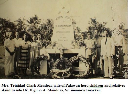 was unveiled in Barangay Jolo on September 28,1991 by Governor Victoriano J. Rodriguez and Congressman David A. Ponce de Leon with other high government officials in attendance. The shrine was constructed near the place where he was captured by the Japanese Imperial Forces, where “ONCE LIVED A MAN WHO PREPARED HIS DESTINY IN HISTORY”. A writer of the Palawan Times wrote, “We came with a single purpose, to witness the unveiling of an Historical Shrine in honor of Dr. Higinio A. Mendoza, Sr”
HE DIED THAT WE MAY LIVE !!!
One of the significant and meaningful effects of the Second World War, particularly the Japanese occupation of Puerto Princesa was the execution of a highly respected and deeply loved leader, Governor Dr. Higinio Acosta Mendoza, Sr.
Dr. John A. C. Mendoza writes:
It was their 11th Wedding Anniversary on January 7, 1944 when a soldier reported to Governor Mendoza, who was then at home with his family in Jolo, that a launch towing two barges loaded with Japanese soldiers were sighted. Doing his regular daily routine, Governor Mendoza tuned in the radio and wrote down the events of the war for distribution to the neighboring barrios to as far as Caramay.
The turn of events came fast and frightening. As Governor Mendoza sat down for breakfast, the morning silence was shattered by the sound of a single shot of the rifle followed by the wild firing of rifles just as he was in the act of raising his first spoonful of food to his mouth. Instinctively, he ran to the bedroom where all the members of the family were gathered. He grabbed his long bolo and slung it over his shoulder. He got his rifle and cocked it. Sensing that the rifle shot was intermittent and was not directed to his house, he opened the bedroom door. But to his surprise, there were several Japanese soldiers inside his house and were pointing their rifles at him and the members of his family. Calmly, he submitted himself voluntarily for fear they would harm his family.
Stoically, he was disarmed and brought downstairs. With a serene voice he talked to his wife, saying, “Trining, think of this happening on our 11th Wedding Anniversary”. Trining asked “what shall we do?” Governor Mendoza solemnly replied, “sweetheart, be brave, we can die for our country.”.
Then the Japanese soldiers displayed horrors of cruelty as he was led away from his family, he was roughly manhandled, using the butts of their rifles and jujitsu stroke. Trining seeing her husband bleeding, cried out, “Daddy! Daddy!” bolting through the cordon of Japanese soldiers, she was kicked in the abdomen and hit on both arms with rifle butts. Groaning in pain and helpless, Governor Mendoza was stunned by this inhuman act. All he could do was just look with unbearable pain for he could not break away from the clutches of the Japanese soldiers as both his hands were tied with a rope on one end and the other end of which was held by Japanese soldiers. Governor Mendoza was made to lead the column from Jolo to Tinitian. He was subjected to interrogation by the arrogant Filipino puppet soldiers and Japanese soldiers. He was then brought to Puerto Princesa. Knowing that it would be the last time he would see his family, his parting words to his eldest son John (known to his relatives and friends as Sonny), who was nine years old at that time, was “take care of Mama”.
An atmosphere of fear and apprehension prevailed among the residents of Puerto Princesa. His sister Agustina and her sons walked from Aborlan to Puerto Princesa or a distance of seventy-two kilometers just to be near Governor Mendoza.
As a gimmick to pacify the Palaweños, particularly those residing in Puerto Princesa, Dr. Mendoza was allowed to deliver a speech at the public plaza. In his speech, he bravely said: “It is a lucky day for they came upon me in a house with my family. If I were in camp with my soldiers, there would be much bloodshed as I will never surrender”. Farthest from his mind was to surrender, for even before his capture, emissaries were sent with letters from the Japanese Command offering him the Governorship of Palawan if he would surrender. This was repeated after his capture. But he refused because he cannot betray his country. This account sealed his faith.
The inevitable event came in the early morning of January 24, 1944 when Dr. Mendoza was taken allegedly to treat the sick soldiers at the airport. He was however, actually brought to a remote place in the coconut plantation of his in-laws, the Clark family, in Canigaran where he was secretly executed. “HE DIED THAT THEY MAY LIVE!”
The Japanese, as a cover-up story, released the information that Dr. Mendoza was sent to Manila. Another lie was that he was sent to Japan for further medical training. These were the incredible lies that the Japanese answered Mrs. Trinidad Clark Mendoza every time she and her children asked the Japanese Commander in Puerto Princesa.
The truth surfaced about mid-1947, when Esperanza Clark Marcelo, the elder sister of Trining Mendoza saw a woven crocheted belt with the buckle Iowa University being worn by a Tagbanua working for Dr. Mendoza’s cousin, Eduardo Valencia. It was the same buckle that Esperanza gave a gift to Dr. Mendoza before World War II. She told Trining about it. Thereupon, Trining went to Eduardo Valencia and asked him if they could talk to the Tagbanua.
 The Tagbanua recalled, while they were picking shell-fish at the end of Canigaran Beach, they heard a truck approaching. Since it was a very isolated place they became curious. They hiding behind the bushes, watched what was happening. About five or six Japanese soldiers formed a line in front of Dr. Mendoza whose hands were tied behind his back. One of the Japanese directed a Filipino-Japanese mestizo puppet soldier to stand in front of the line of Japanese soldiers and ordered him to shoot Governor Mendoza. He fired three times. The Tagbanua saw the puppet soldier hang the belt of Governor Mendoza on a bush. When the Japanese left, he approached the place where Governor Mendoza was shot. They saw what appeared to be a grave. Timod, the Tagbanua family head, took the belt with him.
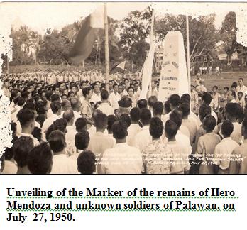
In August 1947, the search party composed of Timod, Angay, another worker, Eduardo Valencia and Governor Mendoza’s sons, John, Higinio, Jr. and David, after two days of intensive search, fofound the remains and exhumed his body and buried it in the grave in the family coconut plantation together with his father-in-law, John T. Clark and Alfred Palanca Clark, a brother-in-law who died during the war.
In early 1951, Governor Alfredo M. Abueg, Sr. proposed to Mrs. Trinidad Mendoza for the transfer of the remains of the late Dr. Mendoza to a more prominent site. The remains were laid in state at the Provincial Capitol for one day. Then, on July 27, 1950, Governor Mendoza’s 53rd birth anniversary, his remains were transferred alongside Rizal Avenue in the place now known as Mendoza Park.
PALAWAN MUSEUM
 A repository of Palawan’s relics and artifacts, among which are those found in the Tabon Caves in the Municipality of Quezon, Palawan, housed in the old City Hall Building located in Mendoza Park. The skull of the first Filipino dated 22,000 years B.C., discovered by Dr. Robert Fox in the 1960s in Tabon Cave was brought to the National Museum.
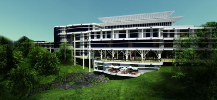
THE NEW CITY HALL BUILDING
The architectural design of the City Hall in Barangay Sta. Monica is unique. Its imposing location at the top of the hill gives it an air of strength. Below the City Hall is the open stadium or the Sports Complex. Along the concrete road from the national highway are the Justice buildings that house the Regional Trial Courts, the City Trial Court  and the Prosecutor’s building. The compound is something not found elsewhere, the blending of resources.
THE PROVINCIAL CAPITOL BUILDING
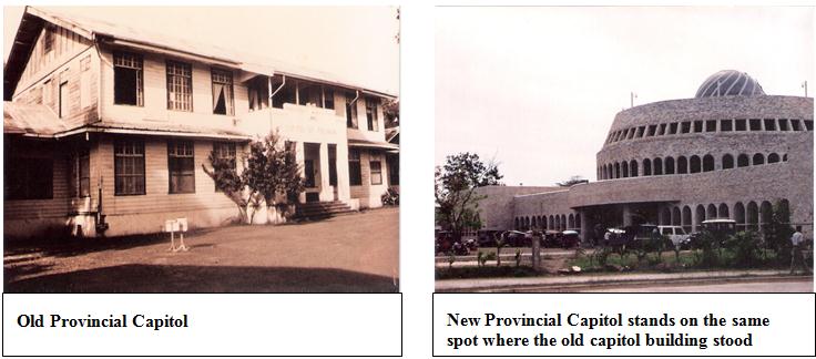 The Provincial Capitol Building is a stand-out in architectural design which depicts Moslem influence indicated in the dome-shaped center roof. It was constructed through the initiative of Speaker Ramon V. Mitra, when Victoriano J. Rodriguez was Governor of Palawan. It is a two-story building with large stairways at each floor, lighted from the transparent dome-shaped center roof.
In front of the Provincial Capitol along Rizal Avenue is a Memorial Marker, a bust of the donor of the lot, Pedro M. Vicente, who served as Mayor of Puerto Princesa for three terms.
THE WESTERN COMMAND
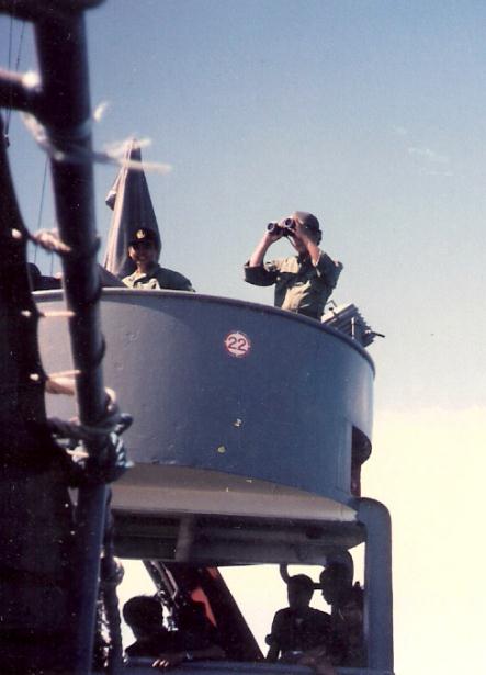 The Western Command (WESCOM) of the Armed Forces of the Philippines was organized on March 15, 1976 under the Command of Commodore Gil Fernandez. Its area of responsibility is the island of Palawan and its surrounding waters.
The first units placed under the Command of the Wescom were the Philippine Marines under the project Kaunlaran of the Philippine Navy and the Composite Tactical Group of the Philippine Air Force (PAF) based in Puerto Princesa.The main mission of Project Kaunlaran was to occupy the Kalayaan Chain of Islands (Spratly Islands) to strengthen the claim of the Philippines over the islands.With the discovery of oil in northwest Palawan, the Wecom expanded its operations. In order to secure the oil well and to complement the changing role of Palawan in national development, the 514 Engineering Composite Battalion of the Philippine Army was placed under the operational control of the Command in order to undertake vital infrastructure projects of the province. Moreover, the Philippine Air Force redeployed its 550 AEW for the lengthening of the Puerto Princesa Airport.
The presence of the Wescom prevented the Muslim rebels from Mindanao in gaining a foothold in southern Palawan. It also checked the establishment of rebel movement in northern Palawan.
Its more specific tasks are: to secure the oil and natural gas exploration in Palawan; defend the Kalayaan Chain of Islands; develop Palawan into an effective defense of the region; and assist in the socio-economic development of Palawan.
IMMACULATE CONCEPTION CATHEDRAL
 The majestic semi-Gothic style Cathedral of our Lady of Immaculate Conception, located near the waterfront, stands on the same spot where the Catholic Church in Puerto Princesa was built in 1872. Bishop Gregorio Espiga in 1965 reconstructed the Roman Catholic Cathedral. It is said to be a replica of the Church of Sto. Domingo de la Calzada in Logronio, Spain. It was designed by Architect Mañalac and constructed under the supervision of Civil Engineer Florencio Llacuna of Cuyo, Palawan. The wood carvings, the wooden Stations of the Cross, the pews and heavy wooden doors were all made by the inmates of the Iwahig Prison and Penal Farm. In the two 60-meter high belfries were eight bells – two dedicated to San Nicolas de Tolentino and Ezekiel Moreno in 1958; four dedicated to San Fernando Rey de España and Saint Joseph in 1921; and two to Our Lady of the Immaculate Conception, Maria Consolatrix Afflictorum in 1965.
On March 10, 1961 the Cathedral was blessed by Archbishop of Manila Rufino Cardinal Santos. It was consecrated on August 15, 1964.
The cathedral stands as a monument of the unparalleled missionary work of the Augustinian Recollects Order (OAR) in Palawan in general and Puerto Princesa City in particular.
APOSTOLIC VICARIATE OF PUERTO PRINCESA CITY
On April 10, 1910, the Apostolic Perfecture of Palawan, the first in the Philippines was erected under the Omnimoda Jurisdiction and Dependence of the Sacred Congregation of the Propaganda Fide. On August 28, 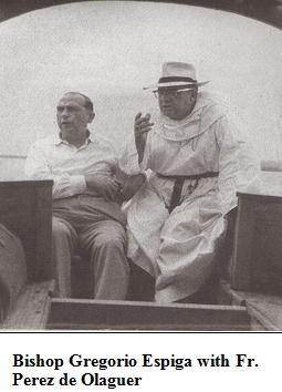 1911, Father Victoriano Roman took possession of the Perfecture with Cuyo as Center. He was succeeded by Father Leandro Nieto in 1939.
On July 1955, the Perfecture was elevated into an Apostolic Vicariate through a Papal Bull issued by Pope Pius XII. Then on September 18, 1955, Bishop Gregorio Espiga y Infante, O.A.R., DD, took possession of the Apostolic Vicariate. Father Joaquin Fernandez, a musician-parish priest had the old parish convent repaired.
In 1966, the Cursillo de Cristianidad was introduced in the parish and the old Seminario de San Jose building was often used as cursillo house.
Father Crisostomo Garnica was appointed the first Filipino Parish Priest of Puerto Princesa in 1967. A saintly and well-loved priest from Dumarao, Capiz, he served until 1970 strengthening the different religious organizations. He was succeeded by Father Casiano Cosmilla. Both priests belong to the Order of the Augustinian Recollects.
On September 11, 1983, The Letter of Appointment of Monsignor Francisco C. San Diego of the Archdiocese of Manila as Coadjutor Bishop of Palawan was read during mass at the Immaculate Conception Cathedral. Bishop Espiga held on to his position until December 18, 1987 when he turned over to Bishop San Diego the Vicariate, making the latter the first Filipino Diocesan Bishop as Vicar Apostolic of Palawan.
In 2002, the Holy See issued a bull that divided the Apostolic Vicariate of Palawan into two new Apostolic Vicariate, Puerto Princesa and Taytay.
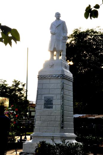 RIZAL PARK
Typical feature of Philippine parks is the statue of Dr. Jose Rizal, the Philippine National Hero. It is usually located in the town or village center. However, in Puerto Princesa, the Rizal Park is located a few meters away from the main door of the Cathedral. This can be attributed to the fact that during the Spanish era, the church stands in the center of the plaza complex.
PLAZA CUARTEL
It is the restored ruins of an old Japanese encampment. Beneath the thick towers which serve as the Plaza’s portals are shallow underground dungeons or holding cells. These also served as air-raid shelters.
In the center of the Plaza is a Memorial Marker, the spot where the 154 American Prisoners of War (POW) under the custody of the Japanese Kempei Tai, were gathered and burned to death with gasoline and grenades. Only 11 prisoners lived to tell the story about what happened inside the tunnel. The names of the living soldiers with their address are engraved on the Marker, a grim reminder of World War II atrocities.
They are: Rufus Smith, Huges Spring, Texas; Ernest John Cablos, Chicago; Edwin Petry, Venice, Chicago; Eugene Nielsen, Utah; Elmo Deal, Uba City, Californis; Tommy Daniels, USA; Don T, Schlot, USA; Fern Joseph Barta, Salt Lake Clty; Glen Weddal McDole, Dismoises, Iowa; WMJ Balchus, Martinville, New Jersey; and Alberto D. Pacheco, Denning, New Mexico.
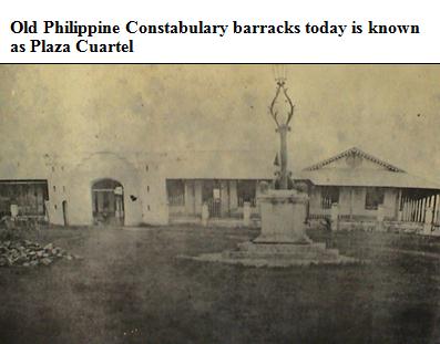 During the Balikatan Exercise 2004 in Puerto Princesa City, two American soldiers: Major Clay Tipton and Lt. Timothy Pound visited the Park and replaced the marker with a new Bronze Memorial Marker, which according to them is “A grim reminder of the realities of war as a price for freedom and the burning to death of American Prisoners of War (POW) inside the tunnel on this very spot on that fateful evening of December 15, 1944.”
UNPARALLELED INHUMAN ATROCITY
Hampton Sides in his book, Ghost Soldiers (New York: Doubleday 2001: 7-17) writes a vivid minute by minute narration of the fate of the 154 American Prisoners of War (POW) under the custody of the Japanese Kempei Tai.
December 14, 1944
Puerto Princesa Prison Camp, Palawan, Philippines
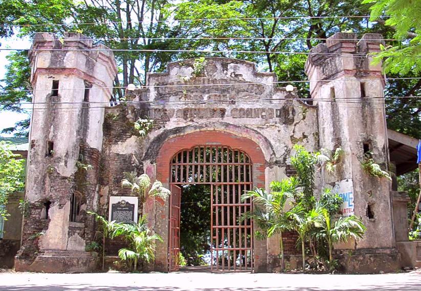 All about them, their work lay in ruins. Their raison d’etre, the task their Commandant had said would take them three months but had taken nearly three years. A thousand naked days of clearing, lifting, leveling, wheel borrowing, backing. Thirty-odd months in close heavy heat smashing rocks into smaller rocks, hammering said hunks of brain coral into bone white flour with which to make concrete. Ripping out the black humus floor of the jungle and felling the gnarled beasts of mahogany or narra or kamagong that happened to be in the way. Above the bay, in a malarial forest skittering with monkeys and monitor lizards, they had built an airstrip where none should be, and now they were happy to see it in ruins, cratered by bombs.
One hundred and fifty slaves stood on a tarmac 2200 meters long and 210 meters wide, straining with shovels and pickaxes and rakes. Ever since the air raids started two months earlier, Lieutenant Sato, the one they called 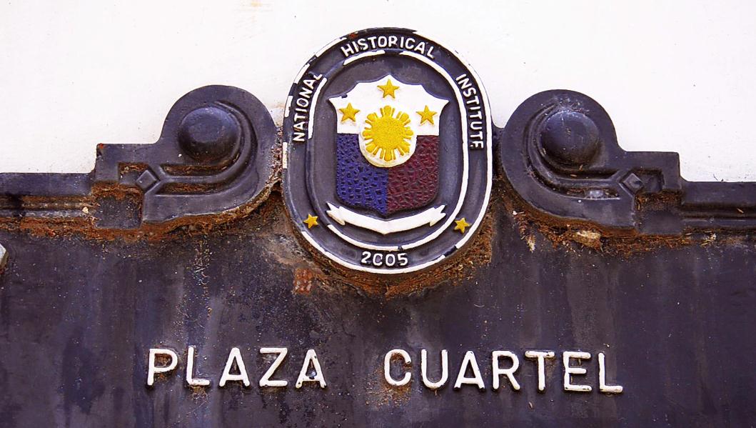 “The Buzzard”, had ordered them each morning to fill the bomb pits, to make the runway usable again. This morning had been different. The men had risen at dawn and eaten a breakfast of weevily rice then climbed aboard and took a break for lunch around noon. But now the Buzzard said no lunch would be served on the strip, that instead the food would be prepared back at the barracks. The men were puzzled because they’d never eaten lunch at their barracks before, not on a workday. It didn’t make sense to drive back now, for they still had considerable repair work to do. Sato offered no explanation.
The prisoners crawled into their trucks again and took the bumpy serpentine road back to the prison. In the meager share of spindly coconut palms, they ate their lunches squatting beside their quarters in an open-air  stockade that was secured with two barbed wire fences. The entire compound was built at the edge of a cliff that dropped fifty ragged feet to a coral beach splashed by the warm blue waters of Puerto Princesa Bay.
Around 1 P.M. the air-raid alarm sounded. It was nothing more than a soldier pounding on an old Catholic church bell splotched with verdigris. The men looked up and saw two American fighters P-38s streaking across the sky but the planes were moving away from the island and were too high to pose a danger. Having become discriminating appraisers of aerial threat, the prisoners ignored the signal and resumed their lunches.
A few minutes later a second air-raid alarm sounded. The men consulted the skies and this time saw an American bomber flying far in the distance. They didn’t take the alarm seriously and kept on eating. Presently, a third air-raid alarm sounded, and this time Sato and a few of his men marched into the compound with saber drawn and descend into the air-raid hovels. “They’re coming!” he shrieked. “Planes-hundreds of planes”.
Again the men were puzzled and this time suspicious. When planes came before, Sato had never registered any particular concern for their safety. Many times they’d been working in the landing strip when American planes had menaced the site, the Japanese would leap into their trenches, but often made the prisoners work until the last possible minute. The Americans had to fend for themselves, out in the open, as aircraft piloted by their own countrymen dropped out of the sky to bomb and strafe the airstrip. Several weeks earlier, an American Kentucky named James Stidham had taken a piece of shrapnel from one of the American Bombers, B-14 Liberator, and was now paralyzed. During the lunch hour he lay on a stretcher in the compound, silent and listless, with a fellow prisoner spoon-feeding him his ration.
“Hundreds of planes!” Sato shouted again, with even more urgency, “Hurry!”
The slaves moved toward the air-raid shelters. They were primitive, nothing more than narrow slits dug four feet deep and roofed over with a few feet of dirt. There were main trenches, each about a hundred feet long. On both ends, the structures had tiny crawling space entrances that admitted one man at a time. Approximately fifty men could fit inside each one, but they had to pack themselves in with their knees tucked in their chins. The prisoners had constructed these crude shelters for their own safety after the American air raid raids started in October, to avoid more casualties like Stidham. With Sato’s reluctant approval, they also painted “POW” on the galvanized roofs of their barracks.
Sato was behaving strangely today, the prisoners thought, but perhaps he knew something, perhaps massive air attack was indeed close at hand. All the signs pointed in the imminent arrival of the American forces. The tide of the war was turning fast – everyone knew it.
That very morning a Japanese seaplane had spotted a convoy of American destroyers and battleship churning through the Sulu Sea en route to Mindoro, the next large island north of Palawan, if not today, then someday soon Sato and his company of airfield engineers would have to reckon with the arrival of U.S. ground troops, and their work on Palawan would be finished.
Reluctantly, the American prisoners did as they were told, all 150 of them, crawling single file into the dark, poorly ventilated pits, everyone but Stidham, whose stretcher was conveniently placed beside one of the trench entrances. If the plane came his buddies would gather his limp form and tuck him into the shelter with everyone else.
They waited and waited but heard not a single American plane, let alone a hundred. They huddled in the stifling darkness of their collective body heat, sweat coursing down their bare chests. The air-raid bell continued to peal. A Navy signalman named C. Smith refused to go into his pit. Suddenly the Buzzard set upon him. He raised his saber high so that it gleaned in the midday sun, and with all his strength he brought its blade side down. Smith’s head was cleaved into two, the sword finally stopping midway down the neck.
Then, peeking out of the ends of the trenches, the men saw several soldiers busting into the compound. They were carrying five-gallon buckets filled with a liquid. The buckets sloshed messily as the soldiers walked. With a quick jerk of the hands, they flung the contents into the openings of the trenches. By the smell of it on their skin, the Americans instantly recognized what it was – high octane aviation fuel from the airstrip. Before they could apprehend the full significance of it, other soldiers tossed flames. The men squirmed over each other and clawed at the dirt as they tried desperately to shrink from the intense heat. They choked back the smoke and the fumes, their nostril assailed by the smell of singed hair roasting. They were trapped like termites in their own sealed nest.
Only a few managed to free themselves. Dr. Carl Magno, from Pennsylvania, sprang from his hole, his clothes smoldering; his arms were outstretched as he pleaded – “Show some reason, please God show reason” – but a machine gunner mowed him down.
Another prisoner crawled from his trench, wrested a rifle from the hands of a soldier, and shot him before receiving a fatal stab at the back. A number of men dashed toward the fence and tried to press through it but were quickly riddled with lead, leaving a row of corpses hung from the bared strands like drying cuttlefish. A few men manage to slip through razor ribbon and leap from the high cliff, but more soldiers were waiting in the beach to finish them off. Recognizing the futility of escape but wanting to wreak a parting vengeance, one burning prisoner emerged from his trench, wrapped his arms tightly around the first soldier he saw, and didn’t let go – a death embrace that succeeded in setting the surprised executioner on fire.
All the while, Lieutenant Sato scurried from trench to trench with saber drawn loudly exhorting his men and occasionally punctuating his soldiers with a high, nervous laugh. At his order, another wav e of troops approached the air-raid shelters, throwing grenades into the flaming entrance and raking them with gunfire. Some of the troops poked their rifle barrels through the entrance of the trenches and fired point- blank at the huddled forms within. James Stidham, the paralytic who had been watching all of these from his stretcher, quietly moaned in terror. A soldier stepped over to him and with perfunctory glance fired two slugs into his face.
When Lieutenant Sato was satisfied that all 150 prisoners were dead, he ordered his men to heave the stray bodies into the smoky pit. The soldiers splattered additional gasoline and re-ignited the trenches. They tossed in more grenades as well as sticks of dynamite to make it appear as though the victims had perished in an air-raid after all, with the shelters receiving several “direct hits” from American bombs. The immense pall of smoke curling from the three subterranean pyres was noted by observers five miles distance, across Puerto Princesa Bay.
Entries from Japanese diaries found at the camp spoke hauntingly of December 14. “Although they were prisoners of war” one entry stated, “they truly died a pitiful death. From today on I will not hear the familiar greeting ‘Good morning Sergeant Major’ ”. Another mentioned that on the beach below the camp, the “executed prisoners (are) floating and rolling among the breakwaters,” said another. “Today the shop is a lonely place. There are numerous corpses . . . and the smell is unbearable”.
EUGENE NIELSEN’S TESTIMONY
On January 7, 1945, an officer from the Army’s Intelligence Branch known as G-2, sat down with a man named Eugene Nielsen, who had a remarkable story to tell. Their conversation was not casual. It was an official interrogation, and the Intelligence Officer, a Captain Ickes, had taken notes. At the time of the debriefing, Nielsen and Ickes happened to be on the tropical island of Morotai, a ting speck in the Spice Islands of the Dutch Indies that had become a crucial stepping-stone in General McArthur’s drive toward Japan. Eugene Nielsen was an Army First Class who had been with the 59th Coast Guard Artillery on the besieged Island of Corregidor – directly across from Bataan – when he was captured by the Japanese in May 1942. He was born and raised in a small town in the mountains of Utah. Nielsen was twenty-eight years old and three of those years he had spent languishing in a prison camp near the Palawan capital of Puerto Princesa. There he had done backbreaking work on the airfield detail, crushing rock and coral and mixing concrete by hand.
Nielsen had been evacuated to Morotai along with five other 3-ex-POWS. He was convalescing while awaiting shipment home to the United States. Although he was racked with the residual effects of the various disease he’d contracted while serving in the tropics, he had recovered much of his strength since his escape from prison. He had two bullet wounds which were still on the mend.
The officer from G-2 sat horrified in his chair as Nielsen told his story, which concerned an incident in Palawan several weeks earlier. The full details of which no official from the U.S. Army Intelligence and apparently heard before.
The trench smelled very strongly of gas. There was an explosion and flames shot through the place. Some of the guys were moaning. I realized this was it – either I had to break for it or die. Luckily I was in the trench that was closest to the fence. So I jumped up and dove through the barbed wire. I fell over the cliff and somehow grabbed a small tree which broke in my fall and kept me from getting injured. There were Japanese soldiers posted on the beach. I buried myself in a pile of garbage and coconut husks. I kept working my way under until I got fairly well covered up. Lying there, I could feel the little worms and bugs eating holes in the rubbish, and then I felt them eating holes into the skin of my back.
When he looked around, Nielsen realized that a surprising number of Americans had made it down the beach – perhaps twenty or thirty. Some, like Nielsen, had tore bare-handed through the barbed wire, but the largest group had made it down by virtue of subterranean accident: a natural escape hatch that led from one of the trenches out to a shallow ledge in the eroded cliff wall. Several weeks later, while digging the air-raid pits, some of the Americans had serendipitously discovered this small fissure, and they’d had the forethought to conceal it by plugging the opening with sandbags and a veneer of dirt so that the Japanese would never see it. They had thought, in a not very specific way that this tunnel might come in handy someday, and though the hole and burrowing out to the rock landing. From there they jumped down to the beach, where they hid among the various crevices and rock outcroppings.
By doing so they gained only a temporary reprieve, however, trading one form of butchery to another. Eugene Nielsen, stilly lying in the refuse heap, heard gunfire sputtering up and down the beach. Systematically, the soldiers were searching the rocks and hunting down fugitives. It was obvious that they intended to exterminate every last one. The prisoners camouflaged themselves with slathered mud and cringed in the rocky cliff folds, lacerating their legs and feet on the coarse coral as they tried to squeeze into every tighter recesses. Other prisoners took refuge in sewage pipe that was half-filled with stagnant water, while others concealed themselves with thick mattresses of higher jungle weeds along the banks.
The seaside massacre went on for three or four hours. The Japanese would pluck their prisoners from their hiding places and slay them on the spot, either by gunshot or by bayonet. Squads of soldiers combed the weeds in tight formation, plunging their bayonets every foot or so until they harpooned their quarry. One American who’d been caught was tortured at some length by six soldiers,one of whom carried a container of gasoline. Seeing the jerry can, the American understood his fate and begged to be shot. The soldiers doused one of his feet with gasoline and set light, then did the same with the other. When he collapsed, they poured the rest of the gasoline over his body and ignited it, leaving him writhing in flames on the beach.
Not far away, a prisoner from South Dakota named Erving Evans, realizing he’d been seen and hoping to avoid the same fate, leaped up from a trash pile where he’d been hiding and blurted, “All right, you bastards – here I am, and don’t miss”.
They didn’t.
They were bayoneting guys down low and making them suffer. They shot or stabbed twelve American and then dug a shallow grave in the sand and threw them in. Some of these men were still groaning, while they were covered with sand. Then the Japs started to cover the grave with rubbish from the pile where I was hiding. They scraped some of the coconut husks off, and found me lying there. Then they uncovered me from the shoulders on down. They thought that I was dead, and seemed to think I had been buried by my friends. I lay there for about fifteen minutes while they stood around talking in Japanese. It was getting too late in the afternoon. One of the boys believed it was time to eat dinner, and every one of the Japs there went off somewhere to eat. I got up and ran down along the beach and hid in a little pocket in a coral reef there.
Down along the coral, Nielsen encountered seven other survivors. One of them was very badly burned. His hair was singed and “his hide was rubbing off when he brushed against anything”. They were all crouched among the rocks, hiding from a barge that was methodically patrolling the coves and foreshores. Having exhausted their hunt by land, the Japanese were now searching by water. Aboard the barge were three or four soldiers armed with rifles as well as tripod machine gun.
Nielsen peeked around the corner and saw a barge coming. He decided he was insufficiently hidden, so he broke off from the group and crouched behind a bush close by. From there he was secreted, they could watch the barge approaching. The Japanese were whispering among themselves and excitedly pointing out crannies that looked promising. One of the seven Americans, a marine from Mississippi named O.J. Warren, wasn’t leaning back quite far enough. The Japanese saw his foot protruding from a rock and immediately shot it. Warren dropped in agony from his wound. In what seemed to be sacrificial act intended to help his comrades, Warren hurled himself out in the open so as not to tip off the whereabouts from the other six. He was immediately shot and killed. The barge passed on.
I left that area and started down the beach. About fifty yards ahead I ran into more Japanese. Suddenly, I realized I was surrounded. They were up above me and also coming from both sides. I was trapped. So I jumped in the sea. I swam underwater as far as I could. When I came up there were twenty Japanese firing at me, both from the cliff and from the beach. Shots were hitting all around me. One shot hit me in the armpit and grazed my ribs. Another hit me in the left thigh, then another one hit me right along the right side of my head, grazing my temple. I think it knocked me out temporarily. For a short period I was numbed in the water, and I nearly drowned. Then I found a large coconut husk bobbling around in the bay and used it to shield my head as I swam.
They kept shooting at Nielsen from the beach. He decided to swim back toward the shore so they think they’d given up and was coming in. He hoped they’d momentarily let up on their fire, and they did. Nielsen then angled slightly and swam parallel to the coastline for about a hundred yards. The Japanese followed him down the beach, patiently tacking alongside him, step for stroke. Occasionally they pinged a shot or two in his direction but mostly they just kept a close eye on him.
I came down to a place along the shore where a lot of trees and bushes in the water. I know they were following me, so I went toward shore and splashed to make a little noise. I wanted them to think I was finally coming in. They abruptly turned around and went out just as quiet as possible and started swimming across the bay. They never shot at me again. Probably it was too dark for them to see me. I swam most of the night. I couldn’t see the other side of the bay but I knew it was about five miles. About halfway out I ran into a strong current. It seemed like I was there for a couple of hours making no headway. Finally, I reached the opposite shore and crawled on my hands and knees up on the rocks. I was in a mangrove swamp. I was too weak to stand up. It was about 4 A. M. I’d been swimming for nearly nine hours.
Washed up on the far shores of Puerto Princesa Bay, Nielsen was pitiful sight – naked. Nursing two bullet wounds, his skin crosshatched with lacerations. He rested for a few hours and then stumbled half delirious through the swamp until he encountered a Filipino who was walking along a path, wielding a bolo knife. In his current state, Nielsen was suspicious of anyone carrying a knife. “I could not imagine how he could be so cool”. Nielsen asked the man to take down a letter. “I think I am the only one alive from the Palawan prison camp”. He said, “I want you to write to the War Department to tell them about the Japanese massacre of the Americans at Puerto Princesa”. Without uttering a word in reaction, the Filipino began to walk away from Nielsen. Then he abruptly turned around and said cryptically, “You have friends here”.
Perplexed, Nielsen followed his new acquaintance down a path through dense jungle to a hideout where Filipino guerrillas were stationed. There, to his amazement, Nielsen encountered two more American survivors from the camp. Albert Pacheco and Edwin Petry. “I didn’t believe it first”, said Nielsen. “I thought I was seeing things”. Each of the two men had his own frisky story to tell, the details varying only slightly from Nielsen’s account. Pacheco and Petry had hidden together in a coral cave that was half flooded with sea water. “The crabs ate on us pretty good down there”, Petry said. The two men were forced to vacate the cave when it became completely flooded at high tide. Like Nielsen, they started swimming across the bay around dusk, but they enjoyed more favorable currents.
Later, Nielsen, Pacheco and Petry hooked up with three additional escapees. Still others would wash up over the succeeding days, bringing the total of known Palawan survivors to eleven. One had endured an encounter with sea shark, the last arrival, Glenn McDole from Des Moines, Iowa, was found clinging to a Filipino fish trap out in the bay. Local fishermen handed him half-alive, with the morning catch.
By guerrilla escort, Nielsen and the original five survivors made their way out of the Japanese-held province of Palawan, first by foot and then by an outrigger canoe or banca, powered by blankets that were thrown up as makeshift sails. In January 6, the half dozen men were finally evacuated by Catalina flying boat to the island of Morotai, where they came under the care of the U.S. Army.
PRINCESS EULALIA PARK
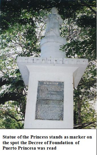 Puerto Princesa was named after Princess Eulalia of Spain. She was born in 1864 to the reigning monarch, Queen Isabella II and her consort Dr. Francisco de Asis. However, with the Princess’ untimely death, the Queen changed the name to Puerto de la Princesa or Princess of Ports. Later it was reduced to Puerto Princesa as it is known today.
The Park which features a pocket forest is located across Rizal Park along Quezon Street. A statue of the Princess serves as a marker as it stands on the spot where the Decree of the Foundation of Puerto Princesa was read by Governor Don Jose de Sostoa y Orduñez, head of the Spanish expedition, on March 4, 1872.
PUERTO PRINCESA BAY
The Bay is known to the Spanish expedition as Baha de la Asuncion or Bay of Asuncion and Punta Asuncion.
Puerto Princesa Bay is situated in the east coast of Palawan. It is deep. Its current flows south to north with its banks indented by second bays where numerous streams empty themselves. The entrance of the bay is marked by two promontories – the Point of Bancao-Bancao in the north and the Point of Banagtauan in the south. At low tide, a part of the slimy bottom of the bay is uncovered on the west coast. The principal rivers which empty into the bay are: Caramuran on the north; Panacan in the northwest; Ygualut and Binuan in the west. Two islets found in the bay are: Isla de Caña, located in the middle of the bay and Rio Island at the mouth of Ygualut River.
The town of Puerto Princesa is built on a piece of land that shelters the bay from the eastern winds. From this point, a chain of mountain ranges can be seen: Mount Pulgar (1208 meters) and Mount Beaufort (1121) towards the northwest; and the Cordillera of the Aldea and Tres Pisos, towards the southwest. Since the bay met the Navy’s requirements, the Commander of the Naval Fleet to Palawan made it the center of its Naval operations.
L.S. TIDEPOLE POINT
 Locals call the place Parola, the native word for Lighthouse. The Lighthouse Reservation was established through Executive Order No. 60 dated July 28, 1903 covering an area of 2,960 square meters. Its tower stands 32 feet above sea level with a visibility range of seven nautical miles flashing red every five seconds with coordinates at 090 43’53’ north latitude and 118043’50.9’ east longitude. It is within the Area of Responsibility (AOR) of the Philippine Coast Guard Station, Puerto Princesa City.
It is the place where the old folks claim they used to see a beautiful princess-like maiden sitting on the rocks during moonlight nights at certain times of the year.
On the promontory of the hill lie the remains of the late Speaker of the House of Representatives Ramon V. Mitra, Jr. It is located in Barangay Bagong Silang, Puerto Princesa City.
CANIGARAN BEACH
It is a long stretch of white sand fringing the shoreline of Puerto Princesa City. This was used by the Americans for their military base.
THE PENAL COLONY
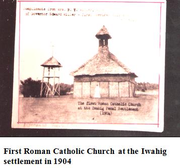 Today, the place is known as the Iwahig Prison and Penal Farm, located twenty-two kilometers south of Puerto Princesa City. It has gained international recognition as the “prison without bars”.
This abandoned Spanish Royal Farm was established on November 16, 1904 when sixty-one prisoners arrived at Iwahig with R.J. Shields, an American as head of the colony. The plan was to use prison labor to clear the forested area to induce people from other places to settle in Palawan. The plan was changed with the passage of Act 1738 in September 1907, designating the colony as a rehabilitation of reformed criminals. It has an area of approximately 38,000 hectares divided into four sub-colonies: the Central with an area of 1,200 hectares, is the site of the administrative offices; Inagawan, 10,600 hectares was established in 1946 as site of the Davao Penal Colony in exile; Sta. Lucia, 9,000 hectares, was founded in 1952 as temporary site of the New Ramon Prison and Penal Farm, when the latter was destroyed by floods; and Montible, 7,000 hectares, formerly a logging area of the Central Sub-colony, was established in 1961.
The Central Colony is managed by a Prison Superintendent while the Sub-colonies by Penal Supervisors and 105 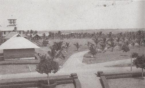 officers and employees. The sub-colonies are divided into working stations: farming, animal husbandry, engineering and construction, forestry, fishing, coconut ands coffee plantation, handicraft, education and cultural arts and institutional services.
The officers and employees are assisted by ranking inmates called “mayors” and “capatazes”. They take charge of work details and are appointed by the Superintendent upon recommendation of the Board of Merit. Besides the petty officers, inmate “trustees” are trained and mustered to help maintain peace and order and safeguard government property. As incentive, monthly gratuities are given to deserving colonists wherever funds are available: unskilled or unclassified “cuernas”, fifty cents to one peso; assistant petty officer and highly skilled 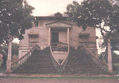 worker, four pesos to six pesos; and mayor or highest ranking colonist, nine pesos to ten pesos.
The colonists enjoy much freedom in their movement within the reservation. They live and work like free men in scattered work-stations which closely resemble typical sitios or barrios. Some prisoners are allowed to live with their families in groups within the reservation apart from the other colonists. Even bachelor colonists are allowed to bring their fiancées or marry the daughter of fellow-colonists.
Adult education classes are conducted to illiterates seven working hours a week. The adult training program is divided into three types: Type A, learning of fundamentals in reading, writing and arithmetic; Type B for graduates of Type A; and TYype C is vocational instruction in bookkeeping, accounting, etc.
 The colony like a free community is provided with basic services: school, postal service, chapel, mosque, recreation halls, hospital and movies. Iwahig Penal Colony is a center of social activities where prominent persons from the neighboring municipalities and high government officials are invited. The Iwahig band participates in activities and programs outside the colony with minimum security. Athletic activities are also regularly held at the colony.
In the early American regime, prisoners whose sentence was nearing completion were trained in this colony on the duties and responsibilities of good citizens. It also at the same time eased out the congestion in prison cells in Manila. During the first year, those who built the buildings and houses were subjected to hardship and shortages. They suffered “much sickness and many deaths” as well as numerous escape attempts and the displacement of the indigenous Tagbanuas.
The colony after undergoing so much development gained for itself the name, “unique institution”, one with a symbiotic relationship with Puerto Princesa. Iwahig was the source of vegetables, fruits, fish and meat for Puerto Princesa.
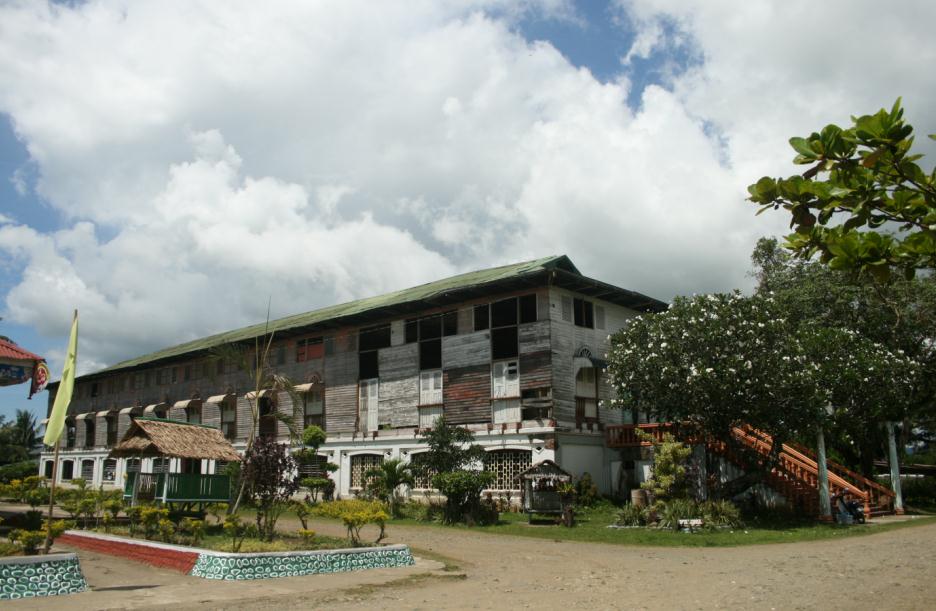 Iwahig was also the social center for festivities and celebrations. Invitations to the Penal Farm during Christmas and New Year and other dates were always a welcome treat for residents in Puerto Princesa for there was an abundance of food and entertainment.
RESORTS AND RECREATION AREAS
TARA COUNTRY GOLF COURSE. The Western Command took over large tracts of public and private lands as military reservation along the airport when it was established in 1976, for reasons of national security. The developed areas were used for housing the headquarters and construction of other facilities, but a larger portion remained a forest.
When the Vietnamese refugees who were rescued in Palawan waters were settled in Puerto Princesa, part of the Wescom reservation along the south side of the airport was used as Vietnamese Refugees village or camp.
It took several commanders to realize the dream of constructing a golf course in the area. It was finally constructed with the help of the Philippine Tourism Authority and City Mayor Edward S. Hagedorn and on November 28, 1994 it opened with an inaugural Golf Tournament participated by military and civilian golfers from Manila and Mactan, Cebu.
To complete the par seventy-two, eighteen holes golf course, the jungles were cleared of undergrowth in the north side of the airport and its squatters.
The project is an example of cooperation of the local stakeholders in development and boost tourism, and more importantly a showcase of an environmentally friendly project. It did not only give Wescom a new look but also promoted the clean and green program of the city government. KAMARIKUTAN KAPE AT GALERI. Kamarikutan is a Cuyono term for wilderness or the wilds. The Kamarikutan Kape at Galeri sits on a sprawling 1.2 hectare property with lush forest surroundings, is home to endemic orchids. Ethnic art exhibits and their cultural songs and dances are being presented monthly. The Galeri welcomes “anyone who appreciates nature-based philosophy”. The native cottage-like place offers a wide variety of paintings and wood carvings done by Palawan artists.
Kamarikutan Kape at Galeri is a mother-daughter tandem of Nanay Dayang and Dinggot Prieto, was conferred by Mayor Edward S. Hagedorn the “Mayor’s Award” for its valuable contribution to the preservation of Puerto Princesa City’s rich cultural heritage by promoting ethnic arts and culture.
AVE MARIA GARDEN. The grotto of the Blessed Virgin Mary was originally established by the Sisters of the Daughter of Charity and rehabilitated by Major General P. S. Millena, Commanding General of the Western Command in 1999. It was the site of the first refugee center for the Vietnamese or Boat people in 1979. It was a source of fresh water for the refugees. It is said that the small cave is an opening of a small underground river that runs up to Parola (lighthouse) traversing through the airport.
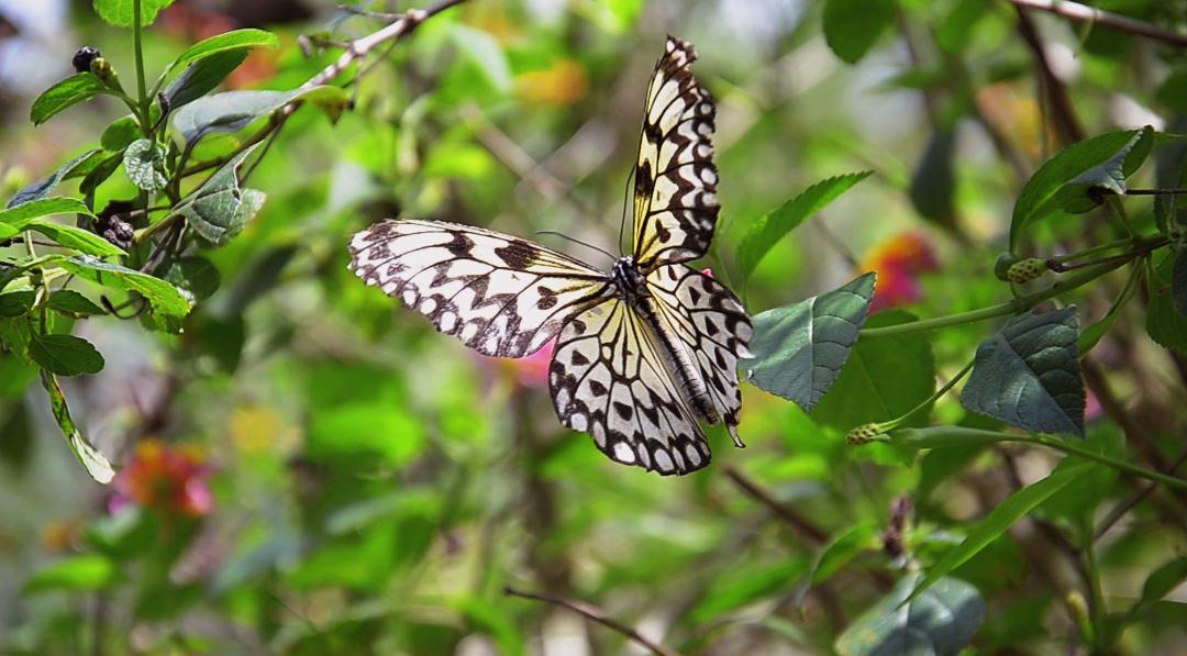 PALAWAN BUTTERFLY GARDEN. The Butterfly Garden, located in Barangay Sta. Monica, is considered the Philippines Gateway to Southeast Asian Butterflies. It teems with live endemic Palawan colorful butterflies and other interesting species which closely resemble those found in Malaysia, Indonesia, Singapore and other Southeast Asian nations.
PALAWAN WILDLIFE RESCUE AND CONSERVATION CENTER. Formerly known as the Crocodile Farming Institute, the Palawan Wildlife Rescue and Conservation Center (PWRCC) is located in Barangay Irawan. A joint project of the Philippines and the Japanese governments, it is a showcase of successful conservation project.
It breeds two endangered crocodile species found in the country including the endemic Philippine crocodile.
In June 2000, the Center not only housed the fresh-water and salt-water crocodiles but also of Palawan’s unique wildlife such as the Talking Mynah or Kiao; Palawan peacock; bear cat; buzzard eagle and others. The Center is nestled in a lush nature park. The main attraction of PWRCC is still the large and baby crocodiles which visitors can watch at close range while being fed.
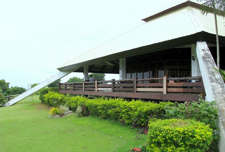 MITRA’S RANCH. The strategic location of the Ranch gives one a spectacular view of Puerto Princesa City stretching all the way to Honda Bay.
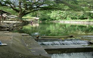 BALSAHAN RIVER SWIMMING RESORT. The resort is located in Barangay Iwahig. This is a favorite picnic area for local residents. Huts line the river’s bank wher clear water flows from the mountain spring.
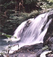 SALAKOT WATERFALLS. A popular tourist spot located midway to Barangay Napsan about 50 meters from the main road. Three layers of water falls plunge into the deep clear pools below. Rare species of butterflies can be found in the area.
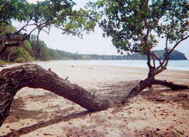 NAPSAN BEACH. The long stretch of sand punctured by rocky promontories, is located in Barangay Napsan, on the west coast, south of Puerto Princesa City. Nestled on the western coast south of Puerto Princesa proper, Napsan offers a tranquil and rustic setting, amid the pristine and serene surroundings. Beautiful sunsets can be viewed from this side.
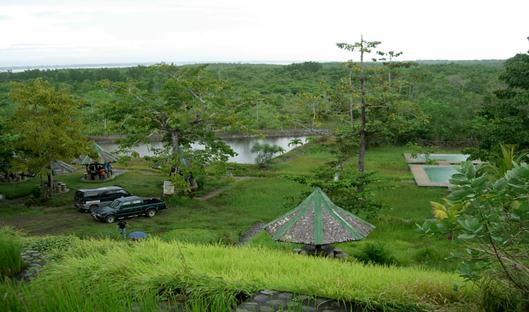 STA. LUCIA HOT SPRINGS. Located at the Environmental Estate formerly the Sta. Lucia Sub-colony, provides an alternate destination for those who are tired of the sand and sea. A series of pools, picnic huts with tables and dressing rooms are among the amenities found in the area. The place is landscaped with trees, ornamentals and flowering that provide a perfect setting for a spa resort.
STA. LOURDES HOT SPRINGS. Located in Barangay Sta. Lourdes, some 14 kilometers from the City proper, the hot springs are contained in swimming pools. It is very accessible as land transportation such as tricycles and jeepneys are available any time of the day.
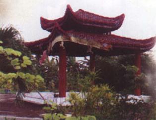 VIETNAMESE VILLAGE. It is located in Barangay Sta. Lourdes, some 14 kilometers north of the City. The village is home to the “boat people” who came in Puerto Princesa in 1979. It gives visitors a glimpse of Vietnamese culture and arts. The Vietnamese asylum seekers who now live a normal life are gainfully engaged in jewelry making and merchandising. But the village is more known for its Vietnamese cuisine.
Earlier, the Philippines First Asylum Camp (PFAC) established in Puerto Princesa City to serve as a transient center for the processing of Vietnamese asylum seekers for eventual resettlement in countries willing to accept them as refugees and repatriation to their mother country.
However, in June 30, 1996 the logistical and financial support for the Vietnamese and administration of these Vietnamese in the PFAC has been withdrawn by the UNHCR in accordance with the 1989 Comprehensive Plan of Action (CPA) for the Indochinese Refugees.
On February 12, 1998 the 8th Sangguniang Panlungsod passed Resolution No. 770-98 endorsing to His Excellency President Fidel V. Ramos the granting of permanent residency status to the remaining 400 Vietnamese nationals in the City. The Vietnamese were administered and supervised by the Center for Assistance to Displaced Persons (CADP), Inc., led by the Director and Program Coordinator Sister Pascale Le Thi Triu, under the auspices of the Catholic Bishops Conference of the Philippines (CBCP). A Memorandum of Understanding between the Department of Social Welfare and Development (DSWD) and the CADP was signed on July 17, 1996, thus the birth of the Vietnamese Village.
With the signing of the MOU, the administration of the PFAC was turned over from the Wescom to the CADP. The asylum seekers were guided by the church to be progressively self reliant and productive.
Vietnamese abscondees or those who departed from PFAC were advised to return to camp not later than November 16, 1996 for them to register for accreditation under the MOU. Their failure to register within the period mentioned meant they had waived their privileges under the MOU and be subjected to immigration rules and regulations.
The Vietnamese asylum seekers departed from PFAC at the end of the year 1996 and were relocated at Barangay Sta. Lourdes, Puerto Princesa City.
On May 12, 1996 all parties gathered at the forum led by City Mayor Edward S. Hagedorn and City Vice Mayor Ceferino Dimalanta signed the Declaration of Support to the efforts of the Catholic Church in addressing the problem of the Vietnamese asylum seekers in the Philippines. That they would extend assistance to make the self-reliant program of the Church-NGOs a reality.
ELSA PARK. It is located 36 kilometers from the City proper in Sitio Nagsaguipi, Barangay Sta. Cruz. The park is surrounded with tall trees and crossed by the Nagsaguipi River. It has a primitive enchanting beauty with one side of the river a good swimming area. The park was named after Elsa Macalinao, first wife of Governor Salvador P. Socrates. It covers an area of 700 hectares. Resolution No. 356-2002 passed by the Sangguniang Panlungsod renamed it Elsa Socrates Park and Ecological management Project.
SALVACION VIEWDECK. One gets a panoramic view of Honda Bay, its a dozen or more islands with a wide expanse of greenery fronting the east coast.
SUSTAINABLE DEVELOPMENT OF HONDA BAY
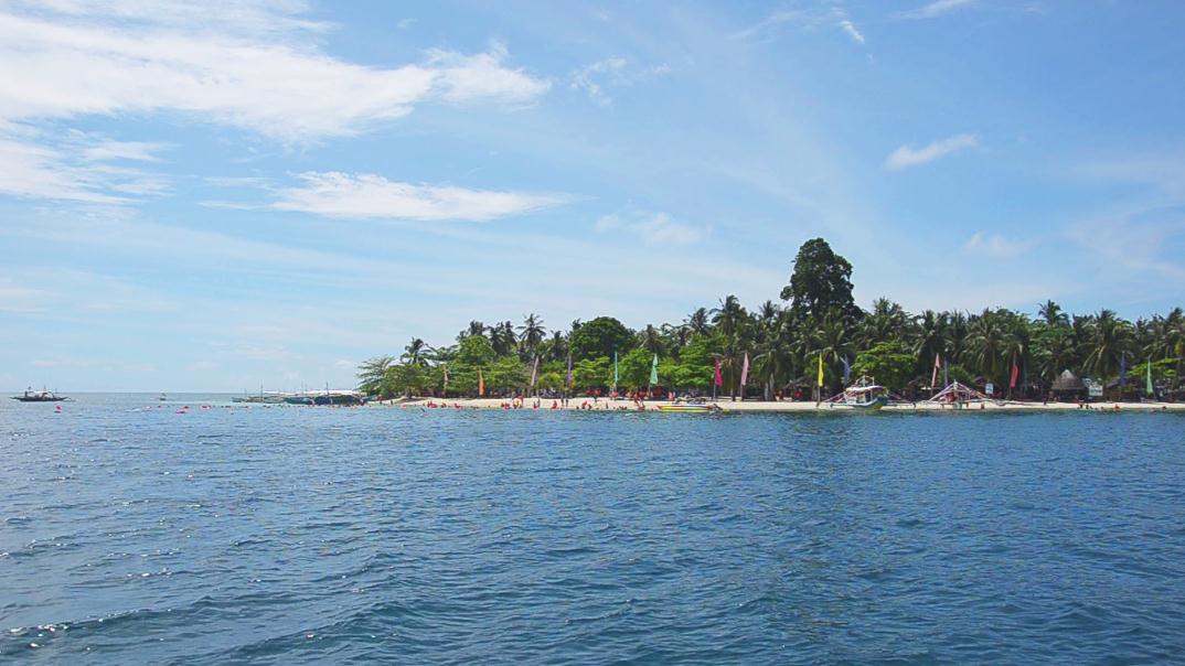 Honda Bay is one of the several areas that can be cited for its sustainable development into resorts of paradise.
The natives call the place “unda”, which means “deep”. Authorities contend that Honda Bay was derived from the Sapnish words “honda aqua” which mean “deep water.”
A Japanese visitor described the interesting details of Honda Bay’s terrain which is sloping down towards the bottom of the bay, rising up towards the surrounding mountainous landscape.
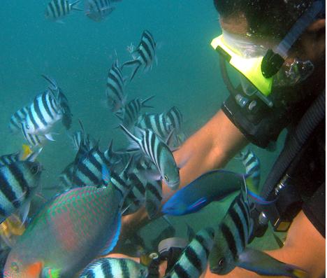 Honda Bay’s rich fishing ground is blessed with extensive in coral reefs and gardens teeming with varied and colorful marine life where thousands of fish and larger marine anumals such as sea turtles, sea cows and whale sharks make their home. It also nurtures different species of seagrass and mangroves, referred to as “nurseries of the sea” because so many fish and shellfish are born and reared in these food-rich environment.
Its string of 12 islands, islets and sandbars of fine powder white sand are clumped with thickets of mangroves and coconut palms.
It is a diver’s haven where clusters of submerged reefs as shallow as ten feet near the small drop-off at Pandan Island, down to 24 feet where you can find small reef aquarium fish play in and out of the reefs. Within the vicinity of Arreceffi Island are Panglima reefs which lie submerged at 20 feet, where you can find coral boulders and gray reef sharks.
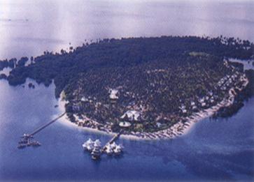 Arreceffi Island, 45 minutes away by boat, one of the farthest of the island in Honda Bay, covers over 20 hectares of which 60,000 square meters have been developed into a resort, Dos Palmas Resort. The rest are mangrove and coral reefs. Seagrass meadows are found among the roots of the mangrove and surround most of the island. Researchers claim that it has more seagrass species than the whole of Thailand with eight species and Japan with seven. These fertile seagrass explains the frequent presence of dugongs or sea cows in the area, as these shy, endangered mammals feed on seagrass. Even juvenile sharks have been observed searching for food in the shallow coral reef areas and seagrass beds.
The Resort is also host of about 70 kinds of birds of which 40 migrate from the cold of Japan and China, these include herons, egrets, frigate and bitterns.
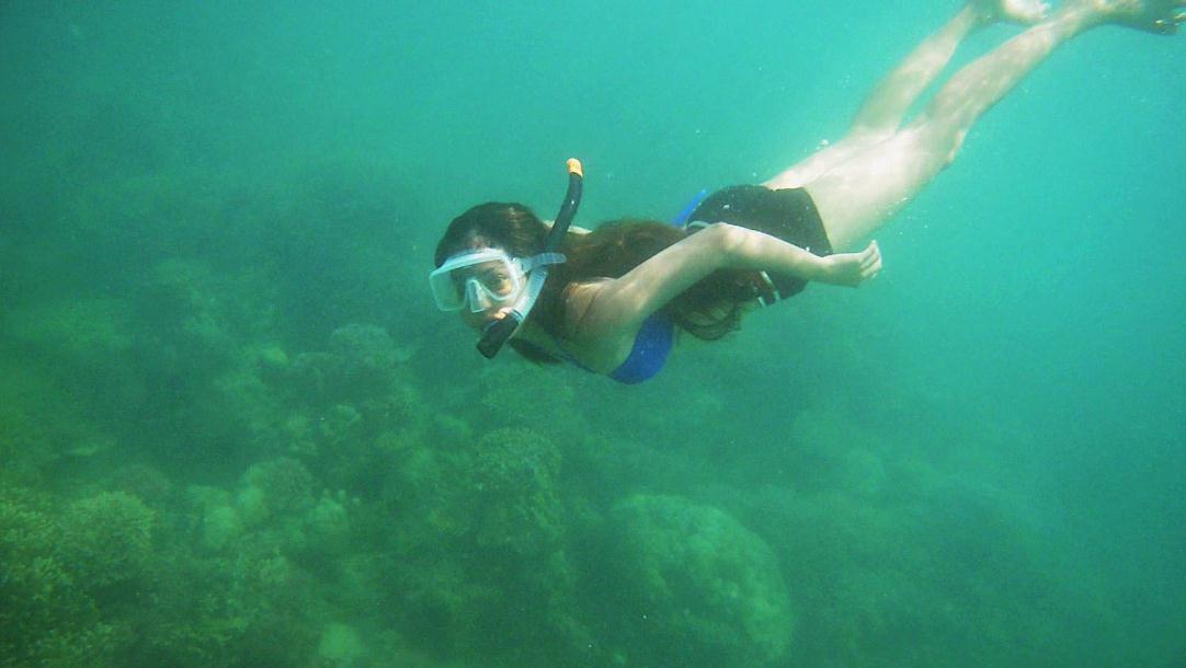 For swimmers who just want to snorkel or merely laze under the sune, take your pick from any
of these islands: Señorita Island; Meara Island; Snake Island (a long strip of island shaped like a snake slithering on the sea’s surface); Starfish Sanbar (a stretch of some 600 meters of white sand towards its crystal clear waters); Cowrie Island (named after the seashell, the golden cowrie, is a typical island of coconut palms along its white sand beach); and Lu-Li Island (name was derived from two Filipino words – Lulubog and Lilitaw which in Englsih menas Submerge-Emerge due toits characteristic to disappear and reappear with the tide’s rise and ebb).
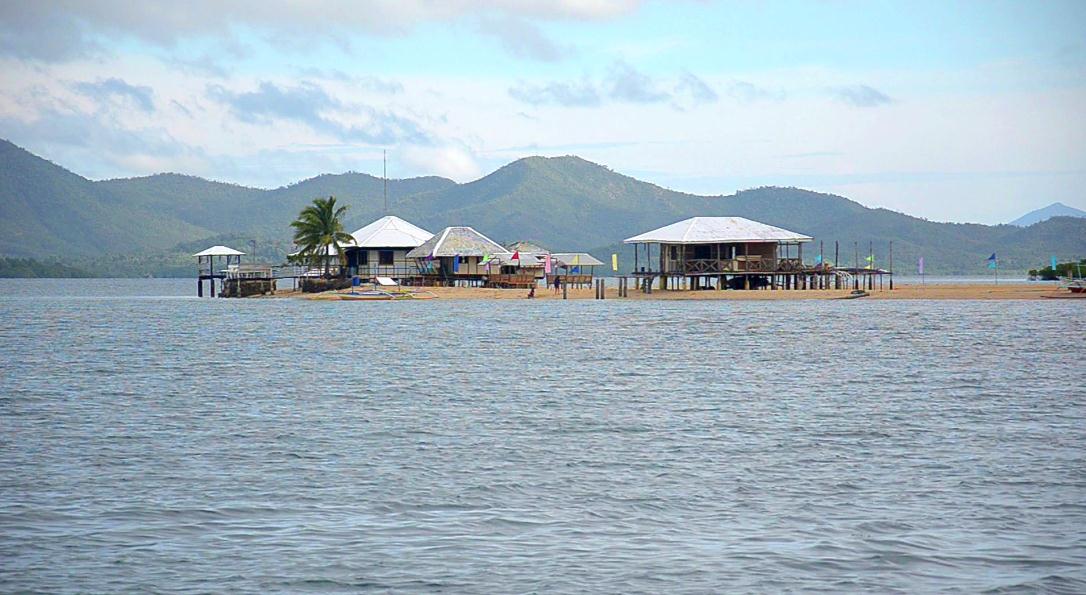 For those who have the penchant for fruit bats, Bat Island is a spectacular sight to watch from a distance, as the bats in various flight formations fly off the island at sunset to nearby islands to search for food.
An added attraction is to watch the sunset in its outburst of colorful hues of red and orange slowly disappearing from one of the islands.
FLORA AND FAUNA
CHERRY BLOSSOM TREE
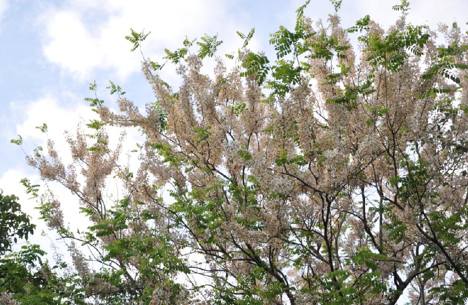 Balayong, the local name for Palawan Cherry, its Scientific name: Prunus javanica and Family name: Leguminosae, is one specie of an ornamental flowering plant which authorities contend as endemic to the Province of Palawan and the City of Puerto Princesa.
It is a kind of hard wood that grows wild in Puerto Princesa and Palawan. It never ceases to be an awesome sight to visitors and natives when it blooms during summer months starting in the month of February. A Japanese visitor was heard to have said that the blossoms are more beautiful than those in Japan and was amazed to find that it blossoms last longer too.
The tree was popularized by the late Governor Higinio A. Mendoza Sr., who ordered the planting of the Cherry Blossom trees along the streets of Puerto Princesa.
The Palawan Cherry is a small to medium-sized tree measuring 15 meters or taller and 50 centimeters in diameter. The leaves are pinnate, 40 centimeters long while the leaflets are ovate with acute tip, 7 centimeters long and 3.5 centimeters wide, green in color and smooth on both surfaces. Its flowering branches are usually drooping 30 centimeters long. The flowers are in loose panicles, light pink, 5 centimeters across. The fruit is cylindrical, hard, smooth, and black when mature.
The plant is endemic to Puerto Princesa City and Palawan as a whole. They are often found in parks and gardens and commonly at the edge of the forest. It is highly probably of hybrid origin and ornamental. The wood is generally used for house construction (doors, posts, floors, frames, rafters, beams, sidings and window jambs), bridges, church pillars, railroad tiles, and also for furniture making such as cabinets, tables, chairs and musical instruments. Today, it is used as substitute fore ipil since it is hardwood. The balayong is also planted in rocky stream beds at 250 meters altitude, in primary and secondary forests from 0 to 1500 altitude.
 GRANDE FLORA
The White Butterfly Orchids or Grande Flora grows in large numbers in the forests in Puerto Princesa. Specimens of white butterfly orchids have won prizes in Orchid Shows held in Manila. The gathering of orchids from Puerto Princesa is regulated.
BIRDS FOUND IN PUERTO PRINCESA
 Palawan Island is also known as a Game Refuge and Haven of Philippine Wildlife. Of the thousand species of Philippine wildlife and birds, 232 species of wildlife and 206 species of birds are found in the island.
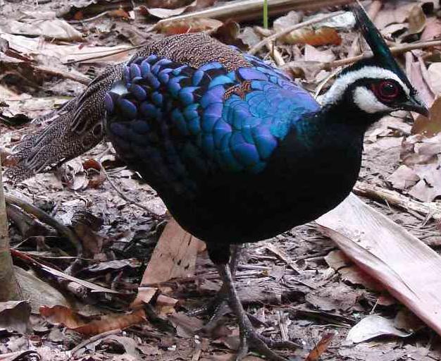 PALAWAN PEACOCK PHEASANT
Among the most prized birds from Puerto Princesa, in fact in Palawan is the Palawan Peacock Pheasant (polyplectron emphanum) known locally as Tandican, is the official seal of the City of Puerto Princesa. The bird is considered the smallest and the most beautiful pheasant in the avian kingdom.
The beauty of the male pheasant is best seen during the mating season when the male becomes deeply engrossed with its courting dance. When it dances, its long pointed metallic blue crest erect and its resplendent bright metallic blue with purple reflections thickly spotted with rusty brown tail feathers open and held vertically until the female is seduced. Usually, several male birds participate in the mating dance. The most accomplished dancer with the most beautiful feathers wins the female bird.
The female Palawan Peacock Pheasant is smaller, with no spurs, crest curved down, seldom visible. Like all peacock pheasants the present species live on the floor of the forest being shy and wary, it is very difficult to see, although common in suitable places. They lay only two eggs in each clutch and nests on the ground.
Allied species is found in Borneo, Himalayas, Indo-China, Hainan and Malay Peninsula and Sumatra. It is sad to note that unless something is done, the bird is on its way to extinction.
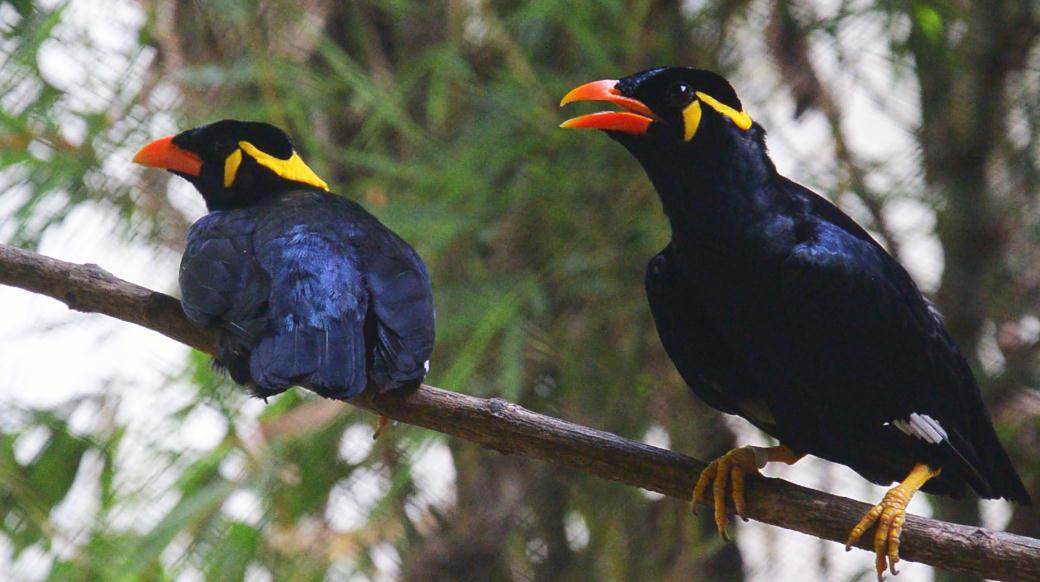 TALKING MYNAH (Gracula religiosa Palanweanis)
The bird is commonly known as the tiyaw. Pigeon sized and almost completely black except for some yellow wattles below the eyes and the nape, it has orange bill and feet. When it flies, patches of white become evident on the wings. It lives on balete trees and feeds on nectar and insects. It is prized for its ability to imitate persons talk like real. The capture of this bird is restricted, if not prohibited, but smuggling them for sale is profitable. It is an endangered specie.
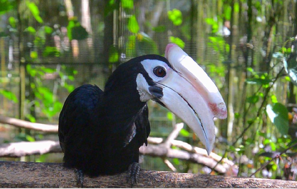 PALAWAN HORNBILL
The male hornbill is a remarkable bird. It is sometimes called “the good family man of the woodland.” A good provider, the male hornbill will not desert its famiy and will stay with its mate until death. It will even go out of its way to support the widow and orphans of another hornbill.
WHITE-BILLED BLACK WOODPECKER
(dryocopus javensis hargetti)
It generally resembles the Philippine subspecies, particularly philippinesis but with bigger bill. A large white patch on the back, throat and sides of the neck much streaked with white. Found only in Palawan Island, where it appears to be rare, one sees isolated specimens restless and shy, moving in the forests, its voice is peculiar.
ANIMALS
Palawan ha a variety of animals with numerous species not found elsewhere in the Philippines. Four of these are found in Puerto Princesa: armadillo, stink badger, Malay Civet cat, porcupine and Palawan Bear Cat.
 ARMADILLO. The armadillo or scaly anteater or balintong, is covered with bony plates, with the exception of the ears and legs. It has a long, sticky tongue with which it catches ants and other insects. It curls up into a ball for protection and rolls away, or it can choose to dig a hole in the ground or seek refuge among the thorny tangles of the forest whenever frightened. This animal is nocturnal.
STINK BADGER. The stink badger is better known for its notorious odor it emits to drive away enemies. This animal is known as pantot. It is a small and gentle animal which resembles a piglet and can be tamed. It feeds on worms and grubs which it digs with its strong claws. It has four short and sturdy legs and its tail is clothed with long bushy hair.
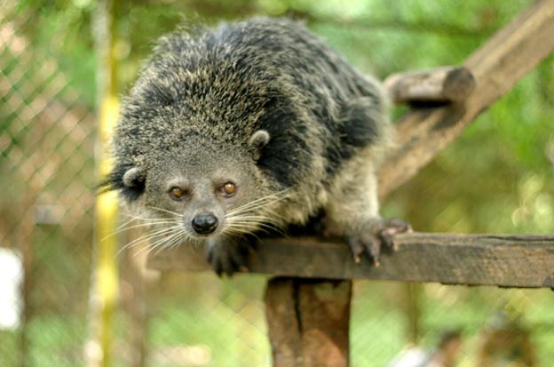 MALAY CIVET CAT. It is a nocturnal animal called locally musang. It derives its name from the tiny sac or gland near its tail which contains civet, a highly valuable odorous substance used as a base for some of the world’s most expensive perfumes. It has a long , bushy and prehensile tail, tuft ears, small eyes, naked soles and palms, a small pointed face and a longish body.
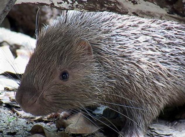 PORCUPINE. The porcupine or durian is a clumsy rodent with protective barbed spines (actually these are modified hair) all over the body which can be fatal to an enemy. The animal is a superb hiker and can walk and swim considerable distances. It can climb trees, usually feeding on wood and inner barks of trees. When offended, its quills shoot out and fasten into the enemy’s body
FESTIVALS AND SPECIAL EVENTS
Fiestas are traditionally Filipino which might have been influenced by the Spanish colonizers in the evangelization of the people. Every Barangay today celebrates its own fiesta in honor of a Patron Saint. This practice has been criticized as expensive which allegedly is the cause of poverty. Be it as it may, fiestas are enlivening activities that rekindle the spirit of unity, cooperation, belongingness and pride.
PISTA Y ANG CAGUEBAN
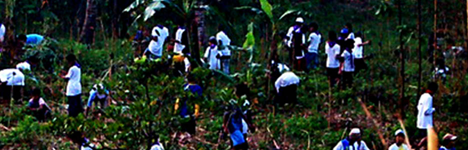 The Pista Y Ang Cagueban or Feast of the Forests was conceptualized by the Development Communication, Training and Community Project Office (PIADPO), now the Palawan Council for Sustainable development Staff (PCSDS), more popularly known as the Development Communication (DEVCOM) Group, with an objective to make people fully and widely aware of environmental protection and conservation issues through the creative use of various media.As envisioned, the Pista is “something big, action-oriented and challenging” not only for the older folks but also for the youth and the children. When the plans were finalized, a massive information
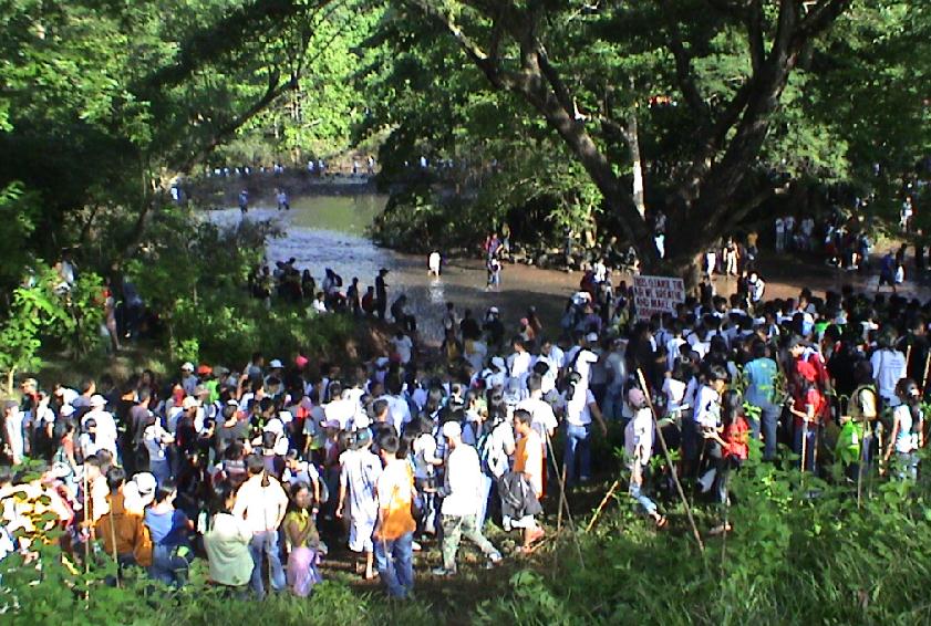 and education drive ensued while government and private entities were mobilized for logistical support. The “bayanihan” spirit came out easy and enjoyable, establishing a great outdoor activity for the whole family
The voluntary massive tree-planting is also a significant step towards solving the problem of water supply shortage. The Irawan Watershed Area, site of an annual activity, is the main source of potable water for the city residents. More importantly, the PISTA shall in a subtle way inculcate in the hearts and mind the true value of conservation and gain a new generation of pro-active environmentalists.
The United Nations declared June as the environmental month. Coincidentally, on June 30, 1991, PCSDS launched the first Pista Y Ang Cagueban. From only 2,500 volunteers from all walks of life who participated in the planting of 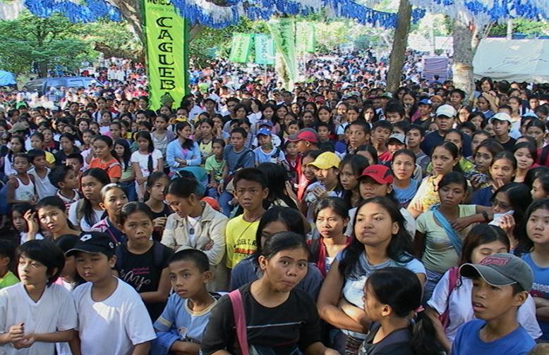 trees in 1991, it grew to 7,500 in 1992. The succeeding years catapulted this event into something that was and will continuously be viewed by all social institutions as a shared responsibility, a direct involvement of the local community and as strict enforcement of environmental laws.
In 1993, Puerto Princesa City Mayor Edward S. Hagedorn adopted and strengthened the Pista Y Ang Cagueban, making it the centerpiece of his environmental rehabilitation program. The Information and Education Campaign (IEC) has been intensified covering all the 66 barangays and linkages with the different sectors of the community established for maximum participation. The City Environment and Natural Resources Office (CENRO) headed by CENRO Rogelio Daquer, handles the technical preparation like : nursery establishment; site preparation; tree planting activity; and the protection and maintenance of the trees. Arrangement for transportation, security, recreation 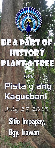 and other activities are likewise given full support by the city government agencies and private groups and individuals.Mayor Hagedorn, known as an assertive, erudite leader and an environmentalist in his own way made a great impact in the community when he led the tree planting activity. His exemplary effort on environmental protection and PISTA’S ingenuity brings new hope for future generations to enjoy the bounties of nature.
There had been birth pains but our leaders has provided the direction vis a vis the necessary support and the people, the inspiration. Thus the number of participants grew to 31,000 in 1993 and 1.3 million trees have been planted covering an area of 135.5 hectares with a survival rate of 80 percent. In 1997, Mayor Hagedorn was among the 21 persons honored by the UNEP for his contributions to environmental protection.
The tree planting activity which highlights every PISTA celebration consists of four major elements: nursery establishment; on site preparation; actual tree planting; and, protection to attain maximum survival rate. Nursery establishment includes soil potting in plastic bags, seeds-gathering and propagation, and care for the seedlings until its plantable stage. Site preparation includes not only the clearing of the area and digging of holes where the seedlings will be planted but also the construction of accessible roads and trails for the participants. Tree planting covers such activities as delivery of seedlings to the planting site, the actual planting and inspection by field personnel. Finally the young plants are periodically visited by Plant Propagators and Forest Rangers and given the proper care and protection until maturity.
Local cultural and environmental groups tog ther with guest artists hold concert in the forest to add color and life to the celebration, a most awaited event by adventure seekers who set up camp days before the tree planting to enjoy a closer encounter with nature. This activity has made tree planting and environmental protection one big fun. Aside from the local leaders and residents, officials from the national government and other personalities have continually take part in the annual celebration held every 3rd Saturday of June.
This can be said of the PISTA Y ANG CAGUEBAN: a fitting tribute to Mother Nature, is a celebration of life, of fun and thanksgiving; a constant reminder of our individual responsibility to care for each other; and for Puerto Princesans, is a way of life.`
On September 26, 2005 during the 64th Regular Session of the 11th Sangguniang Panlungsod of Puerto Princesa passed Ordinance 286 entitled An Ordiance Declaring The Last Saturday of Every Year As Pista Y Ang Cagueban in the City of Puerto Princesa.
The Ordinance is aimed to institutionalize this yearly activity among the constituents of Puerto Princesa City the need to reforest and rehabilitate the denuded forest resources and the importance of protecting and properly utilizing it in order to maintain a wholesome environment and sound ecological balance.
All City residents are enjoined to participate and the City Environment and Natural Resources Office shall identify and recommend specific sites for tree planting, grow suitable seedlings and prepare tree planting sites and protect and care for the young plants until maturity.
LOVE AFFAIR WITH NATURE
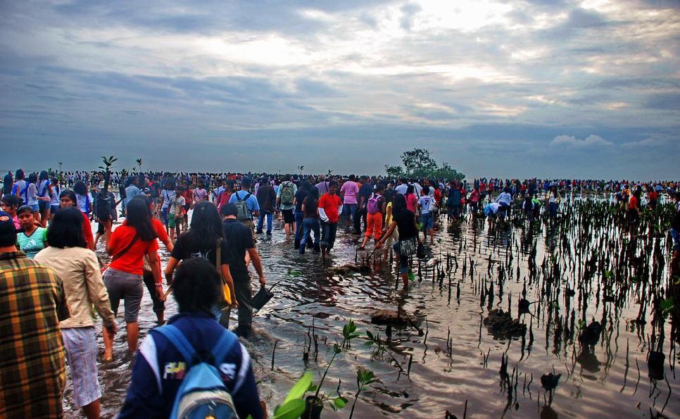 The City Government together with the TagBalay Foundation, Inc. launched “Love Affair with Nature on February 14, 2003 at Barangay San Jose, three months after City Mayor Edward S. Hagedorn assumed office as a Recall-elected Mayor in November 2002.
It was conceived out of eagerness to celebrate “love” every Valentine’s Day. It is a way of expressing love from a personal affair to one which embraces the environment. Its main activity is massive mangrove planting with the aim to rehabilitate the coastal area of Puerto Princesa.
Like the Pista Y Ang Cagueban, it has generated much participation from the people where some would even camp overnight along the shores to wait for the break of dawn to plant the mangrove propagule. The activity is led by 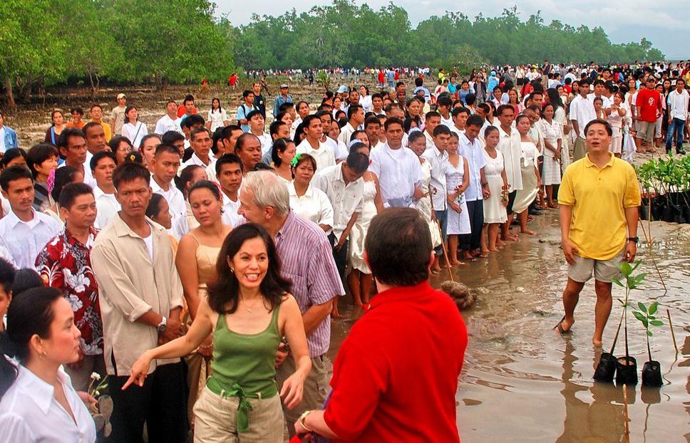 Mayor Hagedorn and Vice Mayor Bayron.
Aside from the planting of mangrove propagules, those who come the night before are entertained by cultural and environmental groups with concert at the seashore and other fun games, contests such as Environmental Quiz Bee and Search for Ms TagBalay Foundation.
The TagBalay Foundation, Inc. (TBF), a non-profit environmental organization founded on February 14, 2003 in Puerto Princesa City, Palawan, Philippines is incorporated as a non-government organization under the laws of the Republic of the Philippines on May 29, 2003.
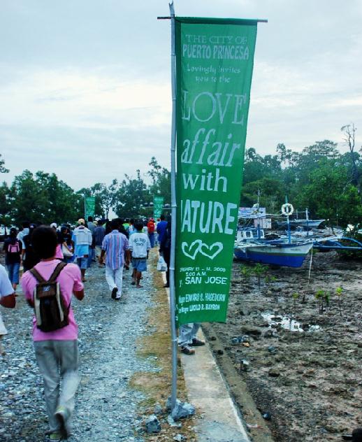 Balay in the Cuyono dialect means house or home while the prefix tag generallt means actor or doer. TagBalay therefore refers to the owner of the house and emotional home and the one responsible for it.
TagBalay is “intercappes” (in modern computer language, the components have their initial letters capitalized without a space separating the components) to reflect the larger symbolic meaning.
TagBalay then is used to refer as to one who considers his environment his house and home under his stewardship entrusted to him by the real owner- God.
Mayor Edward S. Hagedorn who is the Señor TagBalay together with Mr. Peter Flewelling, Mr. Ed Aurelio Reyes, Ms. Sophia R. Jumlani and Ms. Mitzie Gay Bustamante pooled resources together to establish an environmental organization to fight against environmental degradation.
Retiring from the city’s political arena having served three consecutive terms, Mayor Hagedorn decided to continue his service to the people of Puerto Princesa City by way of protecting the environment. However, fate is indeed kind to him, for in September 2002 he won during the Mayoral Recall Elections in September 2002.
The Foundation’s philosophy is to promote environmental protection and preservation through education, innovation, organized action, sustainable development and enforcement activities that will improve the livelihood opportunities 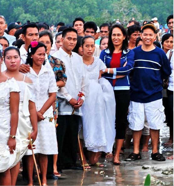 and the quality of life of the people of Puerto Princesa.
“Just as I do not violate our own home, so must I not violate my environment. Instead, I can only preserve, protect or restore it to life. Because, I have embraced it as my own.” This according to the TagBalay precepts is how they want every member of the organization to think of himself/herself, and of the organization as a whole. It is first a personal belief, then an organizational principle and finally the philosophy of an environmental organization. “KAPALIGIRAN KO, TAHANAN KO”
On September 20, 2005 during the 64th Regular Session of the 11th Sangguniang Panglunsod, passed City Ordinance No. 287-2005 otherwise known as AN ORDINANCE DECLARING FEBRUARY 14 OF EVERY YEAR AS “LOVE AFFAIR WITH NATURE DAY” IN THE CITY OF PUERTO PRINCESA.
The Ordinance aimed to institutionalize the “Love Affair With Nautre” and to expand Valentine’s Day expression of love from the customary person-to-person concern to one that embraces Mother Nature and as a continuing call to ensure the protection and sustainable use of our natural resources.
It also enjoins all the residents of this City, government and non-government agencies and the youth sector to participate in this celebration by planting beach trees such as the mangrove, talisay, dangcalan, etc.
“BALAYONG” FLORAL FESTIVAL
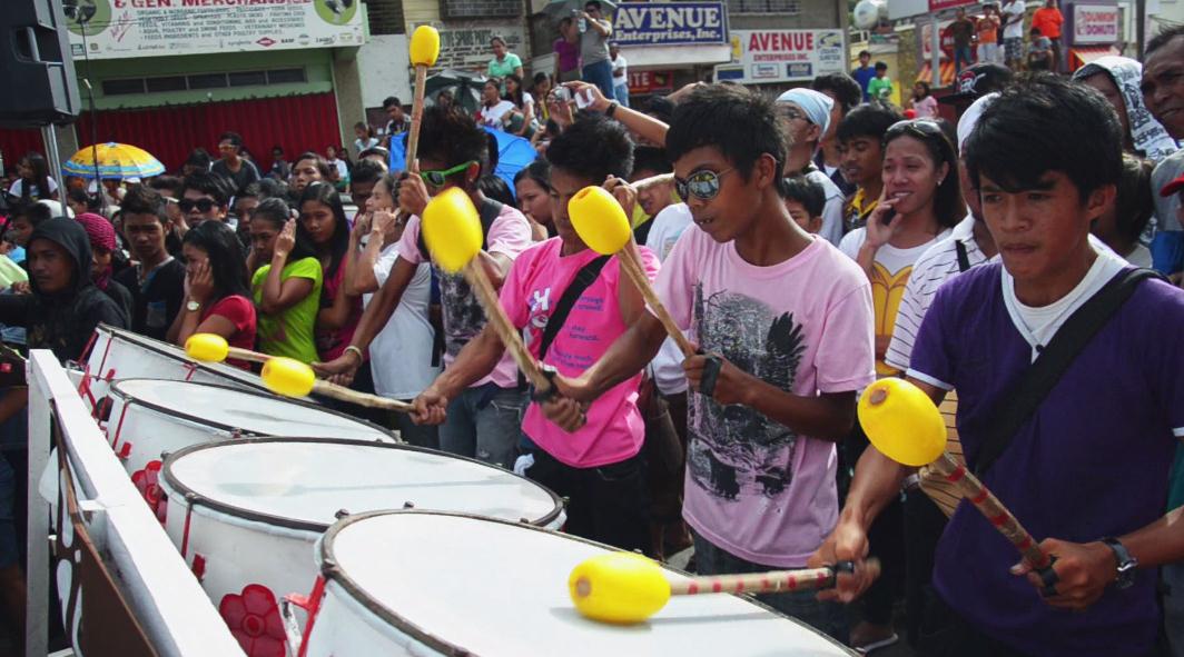 Each year in March 4, the city celebrates its founding anniversary which coincides with the time when the Palawan Cherry burst into an array of colors from white to pink, signaling the start of another season. To the students, its time for school prom and graduation. However, for the religiously inclined, it means that “Flores de Mayo” is just a pace away.
Since the annual activity has no name so to speak, the organizers named it “Balayong” Festival a fitting name for an annual celebration of Puerto Princesa City’s Founding Anniversary. Republic Act No. 7684, approved on February 23, 1994, declared March 4 of every year a special non-working holiday.
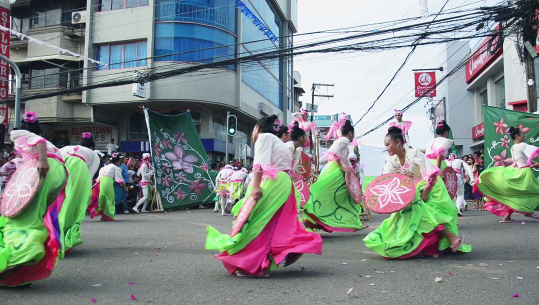 The week-long activity which kicks-off with a thanksgiving mass, includes a social-cultural activity such as the historical parade, search for Miss Puerto Princesa City, merrymaking, street dancing, sports events, Tabuan parade and the massive planting of the Palawan cherry or Balayong.
Sad to say, this specie of ornamental plant is slowly disappearing as this is being replaced by new types of ornamental plants. Thus on March 4, 2004, in celebration of the 133rd Founding Anniversary of Puerto Princesa City, the massive planting of balayong was launched through the initiative of Mrs. Ma. Elena Marcelo Hagedorn, wife of Mayor Hagedorn.
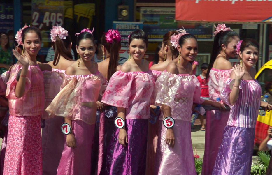 On September 26, 2005 the 11th Sangguniang Panglunsod during its 64th Regular Session passed Ordinance No. 288-2005 entitled AN ORDINANCE DECLARING 4TH DAY OF MARCH OF EVERY YEAR AS “BALAYONG FESTIVAL” IN THE CITY OF PUERTO PRINCESA.
In line with the program of the City Government on Urban Reforestation and Beautification, the main objective of the Ordinance is geared towards the maintenance of a sound ecological balance by preserving and enhancing the quality of environment and natural resources through the propagation and planting of Palawan Cherry (Balayong) an ornamental flowering tree
It also enjoins all City employees, schools and barangays within the Poblacion to hold the Balayong Tree Planting activity.
PANGALIPAY SA BAYBAY FESTIVAL
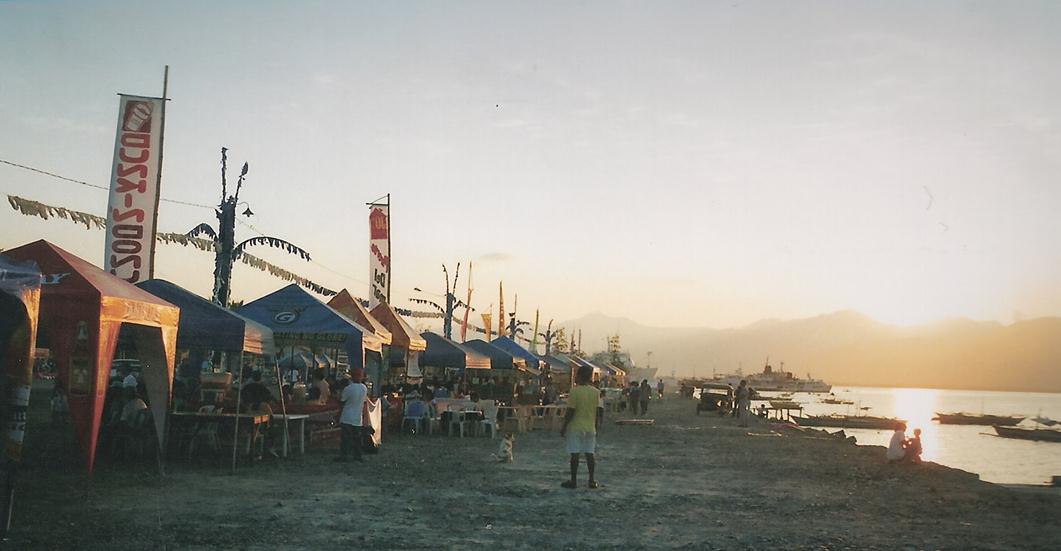 Pangalipay takes its roots from the Visayan word lipay which means merriment. In the native Cuyono dialect, pangalipay means festivity. Baybay in Visayan and Cuyono means the same thing seashore or shoreline. Literally, Pangalipay sa Baybay means merriment or festivity in the seaside.
The festival is celebrated at the three-hectare reclamation area in Barangay San Isidro in April 22-26. The five-day multi-festival is an extravaganza of songs, dances, music, sports and outdoor recreational activities in one setting. Complimenting the activity is a food fair where people can get their choice of food and beverage in food stalls strategically located in the area.
Aside from providing a venue for wholesome recreational activities for the summer, Pangalipay sa Baybay aims to make people aware of the developments in the area once polluted area occupied by illegal settlers.
Under the dynamic leadership of City Mayor Edward S. Hagedorn and City Vice Mayor Lucilo Bayron, the City Coastal Development Plan is conceived to reclaim some six hectares of blighted land covering several barangays to be the site for tenement housing for the poor, six-lane boulevard, restaurants, parks and recreational areas.
KARAGATAN FESTIVAL
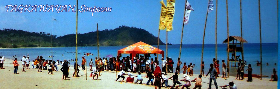 In response to the mandate of Presidential Proclamation No. 57 declaring the month of May as the Month of the Ocean, Mr. Manuel “Boy” Macasaet together with Mr. John Gaston, both environmentalist and nature lover organized the Fiesta ng Karagatan.
It aims to promote Eco-Tourism in the west coast of Puerto Princesa. At the same time project to the resident and visitors alike the importance of protecting its natural habitat from persons who destroy the coral reefs through the use of dynamite, sodium cyanide and other forms of illegal fishing and its forests from illegal loggers. It was first celebrated on May 24-25, 2000 at Matinlo Beach, a private resort owned by Boy Macasaet. It started as a simple gathering of the western barangays of Bacungan, Bagongbayan, Napsan and Simpocan.
The highlight of the fiesta was the release of baby sea turtles hatched in the vicinity of Matinlo Beach led by City First Lady Ma. Elena Marcelo Hagedorn. What made the occasion more memorable was the sports event wherein an 81 year old grandmother won the two-way 50-meter swimming competition.
The Fiesta ng Karagatan was a great success that the organizers agreed to make it a yearly event with one of the barangays as sponsor of the fiesta. Each year the visitors grew in number and the activities more interesting. Additional activities are the “Robo-Robo” group headed by the Motorcross Legend, Mr. Butch Chase; Jean Paul de los Reyes; Harry and Clint Ponce de Leon; Chris Chase; and Jay Macasaet.
In 2004, its fifth year, the name was changed to Karagatan Festival with added features such as: mountain trekking from Irawan to Tagkawayan spearheaded by the Suakwal Mountaineers; the mountain bike race; the Westkini (bikini open) replaced the search for “Mutya ng Karagatan” and beach concert and party to include beach sports activities at the kilometer long stretch of white sand Tagkawayan beach some 35 kilometers west of Puerto Princesa City, coastal clean-up, boat sailing, banca tug-of-war, beach volleyball and football, sand sculpture and a host of other activities.
Some tents were pitched in the beach while others opted to camp at Tent City located at Eagle Point, a kilometers walk from the beach. It gives a panoramic view of the festival grounds and the ocean.
CITY FIESTA
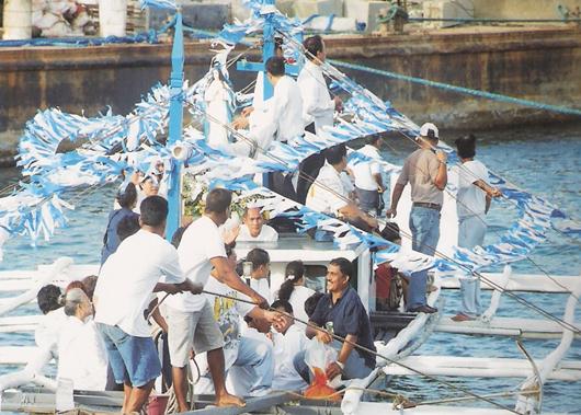 Puerto Princesa City celebrates its fiesta in December 8, the Feast of the Immaculate Conception of Mary. It takes off during the first week of the month with a series of religious activities particularly the nine-day Novena to Our Lady of Immaculate Conception which culminates with a caracol in December 7.
Like other fiestas in the Philippines, colorful processions on land and sea held in honor of the Blessed Virgin Mary highlights the city’s fiesta.
The “caracol” which is a fluvial parade participated by village fishermen in thanksgiving and to implore for a bountiful sea harvest, attests to this honor and tribute to Mama Mary as we lovingly call the Mother of Jesus.
Ma. Rowena G. Pareja in her article “Caracol” Revisited made mention that the Dominicans, who were the first missionaries to come to Puerto Princesa, could have introduced the “caracol” which continues to gain for us the 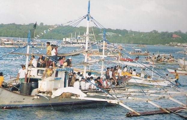 favors of the Almighty through the most powerful intercession of the Blessed Virgin Mary. Name it and you will have it – from the bountiful harvest on land and sea, to the safety of travelers and to just about anything.
A resident of Puerto Princesa, Mrs. Flora Ancheta vividly recalls how colorful and well-participated the procession used to be. The procession of the image of Our Lady of Immaculate Conception passes through Conception Street where the men, women and children lined up in the street and sang religious songs to the accompaniment of two bands. Carpets were rolled out, candles lit, and kwitis (firecrackers) exploded. Prominent men of the community were cantors and they joined the fluvial procession.
Msgr. Mario A. Magbanua, P.C., opines that the “caracol” was an activity inspired by the victories of the La Naval de Manila. On the other hand, Mrs. Carolina Fernandez San Juan states that the “caracol” must have been adopted in the city as easrly as the Spanish period.
To many, joining the Blessed Mother in her tour of Puerto Princesa Bay is an experience which one would not want to miss.
PABILUGON
 “Pabilugon” today known as “Bulanbulawan”, celebrated once a month, it is the revival of an ancient Palaweño tradition of community convergence during the full moon. It has been said that Venetian Chronicler Antonio Pigafetta in his travel with Magellan to this island, wrote about it in his memoirs. “Pabilugon” is an expression of the cultural passion, beliefs and aspirations of the people through songs and dances, creating a wave of energy between the people and the environment. In so doing, promote social bonding among the communities.
BARAGATAN FESTIVAL
Baragatan a Cuyono word which means meeting or converging. The festival is a month long celebration of the Founding Anniversary of the Civil Government of Palawan. It is participated by 23 municipalities and one component city of the Province of Paawan, the private sector and ethnic groups. It features trade and food fair, colorful parade, street dance and the Search for Ms. Palawan, a beauty pageant. Here one witnesses the convergence of people from all over, inside and outside of Palawan as well as culture seen in the pageantry of songs, music, poetry and dances.
PAGDIWATA ARTS FESTIVAL
Artists from all over Palawan converge at Kamarikutan. The festival features week-long workshops in the different arts, painting in different media, sculpture, music, dance and film. Art exhibits and for a, and film showings fill the afternoons, while stage performances and concerts in the evening.
The festival takes inspiration from the Tagbanua’s Pagdiwata Ritual of thanksgiving. In this case, it is a thanksgiving for a bountiful harvest of creativity.
By: WALFRIDO R. PONCE DE LEON
Featured Articles |
USAID/SURGE Project |
Photo Gallery
|

")


